Вход в Екатерининскую шахту.jpg
From Underfoot
Size of this preview: 800 × 530 pixels. Other resolutions: 320 × 212 pixels | 640 × 424 pixels | 1,024 × 678 pixels | 1,280 × 848 pixels | 2,957 × 1,958 pixels.
Original file (2,957 × 1,958 pixels, file size: 3.1 MB, MIME type: image/jpeg)
This file is from Wikimedia Commons and may be used by other projects. The description on its file description page there is shown below.
Summary
| DescriptionВход в Екатерининскую шахту.jpg |
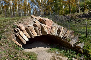
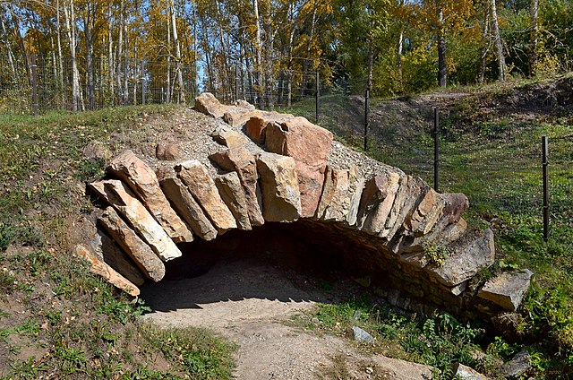
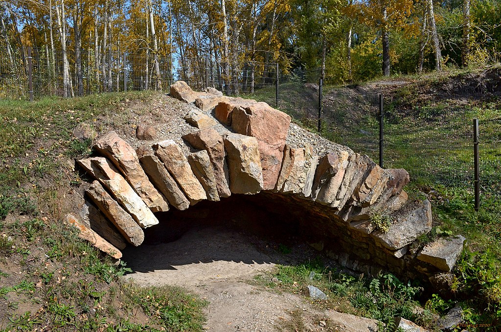
Русский: Вход в Екатерининскую шахту: улица Шумакова, Змеиногорск, Змеиногорский район, Алтайский край
|
||||
| Date | |||||
| Source | Own work | ||||
| Author | Kidus22 |
| Camera location | 51° 09′ 22.14″ N, 82° 11′ 29.6″ E | View this and other nearby images on: OpenStreetMap |
|---|
Licensing
I, the copyright holder of this work, hereby publish it under the following licence:
This file is licensed under the Creative Commons Attribution-Share Alike 4.0 International licence.
- You are free:
- to share – to copy, distribute and transmit the work
- to remix – to adapt the work
- Under the following conditions:
- attribution – You must give appropriate credit, provide a link to the licence, and indicate if changes were made. You may do so in any reasonable manner, but not in any way that suggests the licensor endorses you or your use.
- share alike – If you remix, transform, or build upon the material, you must distribute your contributions under the same or compatible licence as the original.
Captions
Add a one-line explanation of what this file represents
Items portrayed in this file
depicts
51°9'22.140"N, 82°11'29.602"E
18 September 2017
0.005 second
11
18 millimetre
320
image/jpeg
File history
Click on a date/time to view the file as it appeared at that time.
| Date/Time | Thumbnail | Dimensions | User | Comment | |
|---|---|---|---|---|---|
| current | 16:36, 19 October 2020 | 2,957 × 1,958 (3.1 MB) | wikimediacommons>Kidus22 | Uploaded own work with UploadWizard |
File usage
There are no pages that use this file.
Metadata
This file contains additional information, probably added from the digital camera or scanner used to create or digitise it.
If the file has been modified from its original state, some details may not fully reflect the modified file.
| Camera manufacturer | NIKON CORPORATION |
|---|---|
| Camera model | NIKON D5100 |
| Exposure time | 1/200 sec (0.005) |
| F Number | f/11 |
| ISO speed rating | 320 |
| Date and time of data generation | 12:56, 18 September 2017 |
| Lens focal length | 18 mm |
| Latitude | 51° 9′ 22.14″ N |
| Longitude | 82° 11′ 29.6″ E |
| Image title |
|
| Orientation | Normal |
| Horizontal resolution | 300 dpi |
| Vertical resolution | 300 dpi |
| Software used | ACDSee Pro 6 |
| File change date and time | 12:56, 18 September 2017 |
| Y and C positioning | Centred |
| Exposure Program | Aperture priority |
| Exif version | 2.3 |
| Date and time of digitising | 12:56, 18 September 2017 |
| Meaning of each component |
|
| Image compression mode | 4 |
| APEX exposure bias | 0 |
| Maximum land aperture | 3.6 APEX (f/3.48) |
| Metering mode | Pattern |
| Light source | Unknown |
| Flash | Flash did not fire |
| DateTime subseconds | 522 |
| DateTimeOriginal subseconds | 90 |
| DateTimeDigitised subseconds | 90 |
| Supported Flashpix version | 1 |
| Colour space | sRGB |
| Sensing method | One-chip colour area sensor |
| File source | Digital still camera |
| Scene type | A directly photographed image |
| Custom image processing | Custom process |
| Exposure mode | Auto exposure |
| White balance | Auto white balance |
| Digital zoom ratio | 1 |
| Focal length in 35 mm film | 27 mm |
| Scene capture type | Standard |
| Scene control | None |
| Contrast | Normal |
| Saturation | Normal |
| Sharpness | Hard |
| Subject distance range | Unknown |
| GPS time (atomic clock) | 05:56 |
| Reference for direction of image | True direction |
| Direction of image | 36.56 |
| Geodetic survey data used | WGS-84 |
| Latitude destination | 51° 9′ 22.47″ N |
| Longitude of destination | 82° 11′ 29.99″ E |
| GPS date | 18 September 2017 |
| GPS tag version | 0.0.2.2 |
Retrieved from "https://underfoot.info/File:Вход_в_Екатерининскую_шахту.jpg"
