1901 Bingham Utah map.jpg
From Underfoot
Size of this preview: 447 × 599 pixels. Other resolutions: 179 × 240 pixels | 358 × 480 pixels | 573 × 768 pixels | 764 × 1,024 pixels | 1,528 × 2,048 pixels | 2,641 × 3,540 pixels.
Original file (2,641 × 3,540 pixels, file size: 2.33 MB, MIME type: image/jpeg)
Summary
| Description |
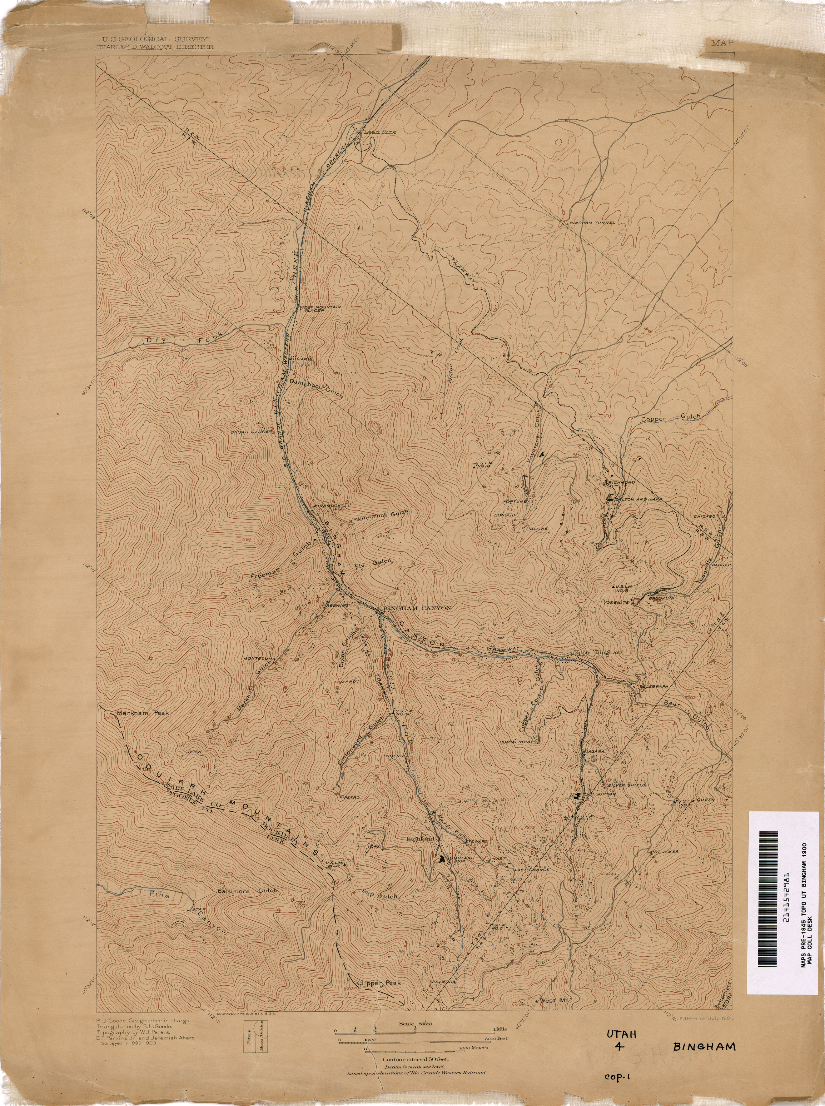
English: A topographic map of the Bingham Canyon mining district in 1901, prior to the beginning of open pit mining operations. |
|||||||||
| Date | ||||||||||
| Source | https://maps.lib.utexas.edu/maps/topo/utah/txu-pclmaps-topo-ut-bingham-1900.jpg | |||||||||
| Creator |
U.S. Geological Survey |
|||||||||
| Geotemporal data | ||||||||||
| Bounding box |
|
|||||||||
| Georeferencing | ||||||||||
| Camera location | | View this and other nearby images on: OpenStreetMap |
|---|
Licensing
This work is in the public domain in the United States because it is a work prepared by an officer or employee of the United States Government as part of that person’s official duties under the terms of Title 17, Chapter 1, Section 105 of the US Code.
Note: This only applies to original works of the Federal Government and not to the work of any individual U.S. state, territory, commonwealth, county, municipality, or any other subdivision. This template also does not apply to postage stamp designs published by the United States Postal Service since 1978. (See § 313.6(C)(1) of Compendium of U.S. Copyright Office Practices). It also does not apply to certain US coins; see The US Mint Terms of Use.
|
 | |
| This file has been identified as being free of known restrictions under copyright law, including all related and neighbouring rights. | ||
File history
Click on a date/time to view the file as it appeared at that time.
| Date/Time | Thumbnail | Dimensions | User | Comment | |
|---|---|---|---|---|---|
| current | 07:20, 5 February 2022 | | 2,641 × 3,540 (2.33 MB) | wikimediacommons>Bplewe | Uploaded a work by U.S. Geological Survey from https://maps.lib.utexas.edu/maps/topo/utah/txu-pclmaps-topo-ut-bingham-1900.jpg with UploadWizard |
File usage
There are no pages that use this file.