Aniche - Fosse Étrœungt de la Compagnie d'Étrœungt (G).JPG
From Underfoot
Size of this preview: 800 × 176 pixels. Other resolutions: 320 × 70 pixels | 640 × 141 pixels | 1,024 × 225 pixels | 1,280 × 281 pixels | 4,912 × 1,080 pixels.
Original file (4,912 × 1,080 pixels, file size: 2.46 MB, MIME type: image/jpeg)
This file is from Wikimedia Commons and may be used by other projects. The description on its file description page there is shown below.
Summary
| DescriptionAniche - Fosse Étrœungt de la Compagnie d'Étrœungt (G).JPG |
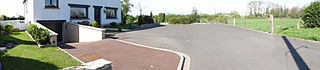
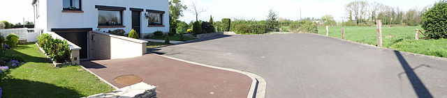
Français : La fosse Étrœungt de la Compagnie d'Étrœungt, devenue la Compagnie des mines d'Azincourt, était un charbonnage du bassin minier du Nord-Pas-de-Calais constitué d'un seul puits situé à Aniche, Nord, Nord-Pas-de-Calais, France. |
||||||
| Date | |||||||
| Source | Own work | ||||||
| Author | Jérémy Jännick | ||||||
| Permission (Reusing this file) |
| ||||||
| Attribution (required by the licence) InfoField | Jérémy-Günther-Heinz Jähnick / Aniche - Fosse Étrœungt de la Compagnie d'Étrœungt (G) / Wikimedia Commons / | ||||||
InfoField | Jérémy-Günther-Heinz Jähnick / Aniche - Fosse Étrœungt de la Compagnie d'Étrœungt (G) / Wikimedia Commons |
| Camera location | 50° 19′ 23.23″ N, 3° 14′ 52.52″ E | View this and other nearby images on: OpenStreetMap |
|---|
Captions
Add a one-line explanation of what this file represents
Items portrayed in this file
depicts
10 April 2011
50°19'23.23200"N, 3°14'52.51700"E
image/jpeg
205fdba0999abc5e5c813afc82d6159b9ad14c80
2,582,600 byte
1,080 pixel
4,912 pixel
0.002 second
3.5
125
4.25 millimetre
File history
Click on a date/time to view the file as it appeared at that time.
| Date/Time | Thumbnail | Dimensions | User | Comment | |
|---|---|---|---|---|---|
| current | 13:23, 24 April 2011 | 4,912 × 1,080 (2.46 MB) | wikimediacommons>Jérémy-Günther-Heinz Jähnick |
File usage
There are no pages that use this file.
Metadata
This file contains additional information, probably added from the digital camera or scanner used to create or digitise it.
If the file has been modified from its original state, some details may not fully reflect the modified file.
| Camera manufacturer | SONY |
|---|---|
| Camera model | DSC-HX5V |
| Exposure time | 1/500 sec (0.002) |
| F Number | f/3.5 |
| ISO speed rating | 125 |
| Date and time of data generation | 11:04, 10 April 2011 |
| Lens focal length | 4.25 mm |
| Altitude | 63.3 metres above sea level |
| Orientation | Normal |
| Horizontal resolution | 72 dpi |
| Vertical resolution | 72 dpi |
| File change date and time | 11:04, 10 April 2011 |
| Y and C positioning | Co-sited |
| Exposure Program | Normal program |
| Exif version | 2.21 |
| Date and time of digitising | 11:04, 10 April 2011 |
| Image compression mode | 5 |
| APEX exposure bias | 0 |
| Maximum land aperture | 3.625 APEX (f/3.51) |
| Metering mode | Pattern |
| Light source | Unknown |
| Flash | Flash did not fire, compulsory flash suppression |
| Colour space | sRGB |
| Custom image processing | Normal process |
| Exposure mode | Auto exposure |
| White balance | Auto white balance |
| Scene capture type | Standard |
| Contrast | Normal |
| Saturation | Normal |
| Sharpness | Normal |
| North or south latitude | North latitude |
| East or west longitude | East longitude |
| Receiver status | Measurement in progress |
| Measurement mode | 3-dimensional measurement |
| Speed unit | Kilometres per hour |
| Speed of GPS receiver | 0.3 |
| Reference for direction of movement | True direction |
| Direction of movement | 5.47 |
| Reference for direction of image | Magnetic direction |
| Direction of image | 259.75 |
| Geodetic survey data used | WGS-84 |
| GPS date | 10 April 2011 |
| GPS differential correction | 0 |