File

Citybanan karta.jpg

From Underfoot

Original file (713 × 853 pixels, file size: 359 KB, MIME type: image/jpeg)

This file is from Wikimedia Commons and may be used by other projects. The description on its file description page there is shown below.

Summary

Description
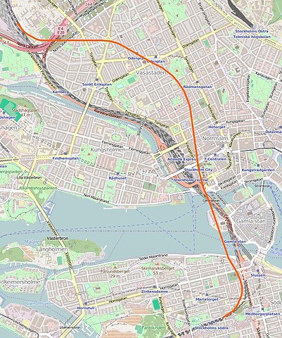
Svenska: Karta över Citybanans tunnelsträckning genom Stockholm
Suomi: Keskustarata Tukholman keskustan kartalla punaisella merkittynä
Date
Source http://www.openstreetmap.org/
Author http://www.openstreetmap.org/ kompletterad av Holger Ellgaard
Permission
(Reusing this file)
Description
This map was created from OpenStreetMap project data, collected by the community. This map may be incomplete, and may contain errors. Don't rely solely on it for navigation.
Date (see file history)
Source You may find a page on the OpenStreetMap wiki page for Citybanan
Creator
OpenStreetMap contributors
Permission
(Reusing this file)
OpenStreetMap data and maps are licensed under the Creative Commons Attribution-ShareAlike 2.0 license (CC-BY-SA 2.0).
w:en:Creative Commons
attribution share alike
This file is licensed under the Creative Commons Attribution-Share Alike 2.0 Generic licence.
You are free:
  • to share – to copy, distribute and transmit the work
  • to remix – to adapt the work
Under the following conditions:
  • attribution – You must give appropriate credit, provide a link to the licence, and indicate if changes were made. You may do so in any reasonable manner, but not in any way that suggests the licensor endorses you or your use.
  • share alike – If you remix, transform, or build upon the material, you must distribute your contributions under the same or compatible licence as the original.
Georeferencing Georeference the map in Wikimaps Warper If inappropriate please set warp_status = skip to hide.

Licensing

Description
This map was created from OpenStreetMap project data, collected by the community. This map may be incomplete, and may contain errors. Don't rely solely on it for navigation.
Date (see file history)
Source You may find a page on the OpenStreetMap wiki page for Citybanan
Creator
OpenStreetMap contributors
Permission
(Reusing this file)
OpenStreetMap data and maps are licensed under the Creative Commons Attribution-ShareAlike 2.0 license (CC-BY-SA 2.0).
w:en:Creative Commons
attribution share alike
This file is licensed under the Creative Commons Attribution-Share Alike 2.0 Generic licence.
You are free:
  • to share – to copy, distribute and transmit the work
  • to remix – to adapt the work
Under the following conditions:
  • attribution – You must give appropriate credit, provide a link to the licence, and indicate if changes were made. You may do so in any reasonable manner, but not in any way that suggests the licensor endorses you or your use.
  • share alike – If you remix, transform, or build upon the material, you must distribute your contributions under the same or compatible licence as the original.
Georeferencing Georeference the map in Wikimaps Warper If inappropriate please set warp_status = skip to hide.

Captions

Add a one-line explanation of what this file represents

Items portrayed in this file

depicts

image/jpeg

384619775e95986e3fbe57cc03dc786e3632f0f5

367,317 byte

853 pixel

713 pixel

File history

Click on a date/time to view the file as it appeared at that time.

Date/TimeThumbnailDimensionsUserComment
current18:27, 11 July 2016Thumbnail for version as of 18:27, 11 July 2016713 × 853 (359 KB)wikimediacommons>AgatefilmNyare kartbild över Stockholm, där hela Citybanan syns.

There are no pages that use this file.