Denain - Fosse Mathilde des mines d'Anzin (26).JPG
From Underfoot
File:Denain - Fosse Mathilde des mines d'Anzin (26).JPG
Size of this preview: 800 × 600 pixels. Other resolutions: 320 × 240 pixels | 640 × 480 pixels | 1,024 × 768 pixels | 1,280 × 960 pixels | 2,560 × 1,920 pixels | 3,648 × 2,736 pixels.
Original file (3,648 × 2,736 pixels, file size: 4.16 MB, MIME type: image/jpeg)
This file is from Wikimedia Commons and may be used by other projects. The description on its file description page there is shown below.
This building is indexed in the base Mérimée, a database of architectural heritage maintained by the French Ministry of Culture, under the reference PA59000163
![]() brezhoneg ∙ català ∙ Deutsch ∙ English ∙ español ∙ Esperanto ∙ euskara ∙ français ∙ italiano ∙ magyar ∙ Nederlands ∙ português do Brasil ∙ português ∙ română ∙ sicilianu ∙ slovenščina ∙ suomi ∙ svenska ∙ Ελληνικά ∙ беларуская (тарашкевіца) ∙ македонски ∙ русский ∙ українська ∙ বাংলা ∙ +/− |
Summary
DescriptionDenain - Fosse Mathilde des mines d'Anzin (26).JPG |
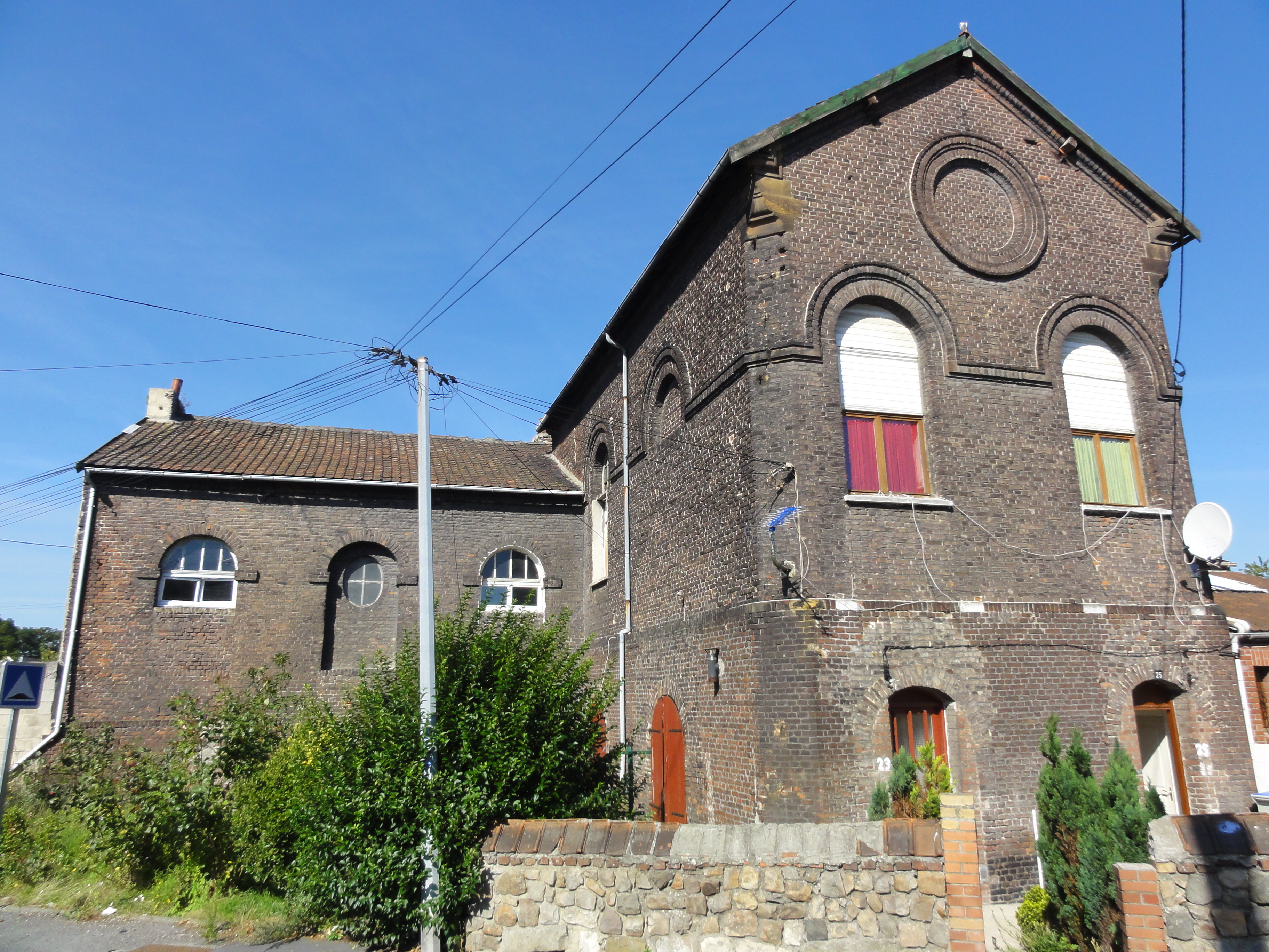
Français : La fosse Mathilde de la Compagnie des mines d'Anzin était un charbonnage du bassin minier du Nord-Pas-de-Calais constitué d'un seul puits situé à Denain, Nord, Nord-Pas-de-Calais, France.
|
||||||
Date | |||||||
Source | Own work | ||||||
Author | Jérémy Jännick | ||||||
Permission (Reusing this file) |
| ||||||
Attribution (required by the licence) InfoField | Jérémy-Günther-Heinz Jähnick / Denain - Fosse Mathilde des mines d'Anzin (26) / Wikimedia Commons / | ||||||
InfoField | Jérémy-Günther-Heinz Jähnick / Denain - Fosse Mathilde des mines d'Anzin (26) / Wikimedia Commons |
Camera location | 50° 22′ 07.36″ N, 3° 11′ 54.71″ E ![]() | View this and other nearby images on: OpenStreetMap | ![]() |
---|
Captions
Add a one-line explanation of what this file represents
Items portrayed in this file
depicts
50°22'7.35499"N, 3°11'54.70800"E
10 August 2011
125
0.004 second
4.25 millimetre
File history
Click on a date/time to view the file as it appeared at that time.
Date/Time | Thumbnail | Dimensions | User | Comment | |
---|---|---|---|---|---|
current | 13:32, 16 August 2011 | 3,648 × 2,736 (4.16 MB) | wikimediacommons>Jérémy-Günther-Heinz Jähnick |
File usage
The following 3 pages use this file:
Metadata
This file contains additional information, probably added from the digital camera or scanner used to create or digitise it.
If the file has been modified from its original state, some details may not fully reflect the modified file.
Camera manufacturer | SONY |
---|---|
Camera model | DSC-HX5V |
Exposure time | 1/250 sec (0.004) |
F Number | f/8 |
ISO speed rating | 125 |
Date and time of data generation | 10:27, 10 August 2011 |
Lens focal length | 4.25 mm |
Altitude | 24.5 metres above sea level |
Orientation | Normal |
Horizontal resolution | 72 dpi |
Vertical resolution | 72 dpi |
File change date and time | 10:27, 10 August 2011 |
Y and C positioning | Co-sited |
Exposure Programme | Normal programme |
Exif version | 2.21 |
Date and time of digitising | 10:27, 10 August 2011 |
Image compression mode | 4 |
APEX exposure bias | 0 |
Maximum land aperture | 3.625 APEX (f/3.51) |
Metering mode | Pattern |
Light source | Unknown |
Flash | Flash did not fire, auto mode |
Colour space | sRGB |
Custom image processing | Normal process |
Exposure mode | Auto exposure |
White balance | Auto white balance |
Scene capture type | Landscape |
Contrast | Normal |
Saturation | Normal |
Sharpness | Normal |
North or south latitude | North latitude |
East or west longitude | East longitude |
Receiver status | Measurement interoperability |
Measurement mode | 3-dimensional measurement |
Speed unit | Kilometres per hour |
Speed of GPS receiver | 0.8 |
Reference for direction of movement | True direction |
Direction of movement | 295.07 |
Reference for direction of image | Magnetic direction |
Direction of image | 264.75 |
Geodetic survey data used | WGS-84 |
GPS date | 9 August 2011 |
GPS differential correction | 0 |