Entrada al túnel 29 Estadio Olímpico Universitario..jpg
From Underfoot
File:Entrada al túnel 29 Estadio Olímpico Universitario..jpg
Size of this preview: 800 × 536 pixels. Other resolutions: 320 × 214 pixels | 640 × 428 pixels | 1,024 × 685 pixels | 1,280 × 857 pixels | 2,560 × 1,714 pixels | 3,872 × 2,592 pixels.
Original file (3,872 × 2,592 pixels, file size: 4.02 MB, MIME type: image/jpeg)
Summary
| Description |
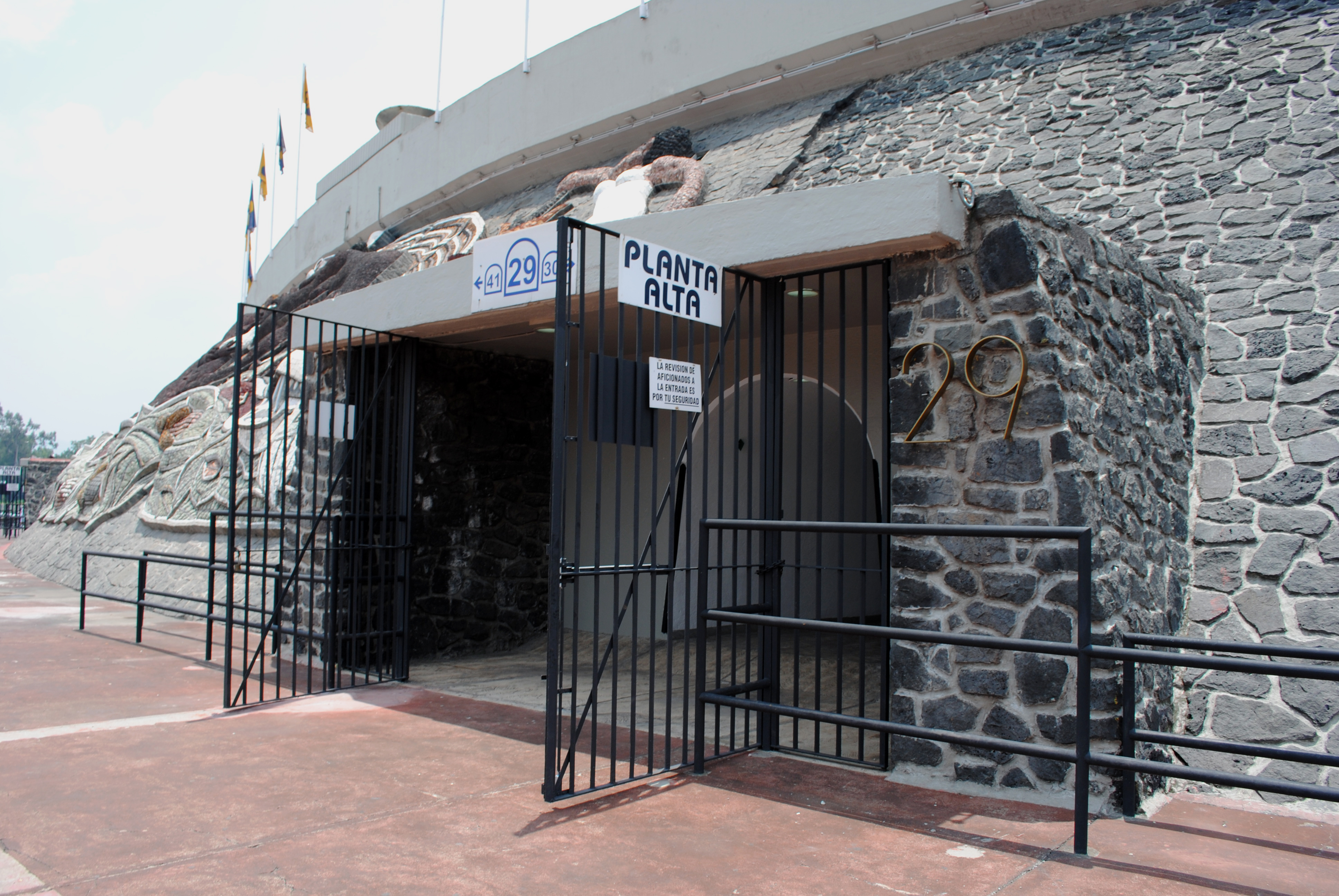
Español: Acceso al túnel 29. En este lugar, el 26 de mayo de 1985 se registró una estampida humana que dejó 8 muertos. English: Access to the tunnel 29. Here, in May 26, 1985 a stampede left 8 dead. |
| Date | |
| Source | Own work |
| Author | ProtoplasmaKid |
| Camera location | | View this and other nearby images on: OpenStreetMap |
|---|
Licensing
I, the copyright holder of this work, hereby publish it under the following licence:
This file is licensed under the Creative Commons Attribution-Share Alike 3.0 Unported licence.
- You are free:
- to share – to copy, distribute and transmit the work
- to remix – to adapt the work
- Under the following conditions:
- attribution – You must give appropriate credit, provide a link to the licence, and indicate if changes were made. You may do so in any reasonable manner, but not in any way that suggests the licensor endorses you or your use.
- share alike – If you remix, transform, or build upon the material, you must distribute your contributions under the same or compatible licence as the original.
File history
Click on a date/time to view the file as it appeared at that time.
| Date/Time | Thumbnail | Dimensions | User | Comment | |
|---|---|---|---|---|---|
| current | 18:49, 10 May 2014 | | 3,872 × 2,592 (4.02 MB) | wikimediacommons>ProtoplasmaKid | User created page with UploadWizard |
File usage
The following page uses this file: