Exsurgence de Port-Miou.JPG
From Underfoot
File:Exsurgence de Port-Miou.JPG

Size of this preview: 800 × 600 pixels. Other resolutions: 320 × 240 pixels | 640 × 480 pixels | 1,024 × 768 pixels | 1,280 × 960 pixels | 2,048 × 1,536 pixels.
Original file (2,048 × 1,536 pixels, file size: 1.4 MB, MIME type: image/jpeg)
Summary
| Description |
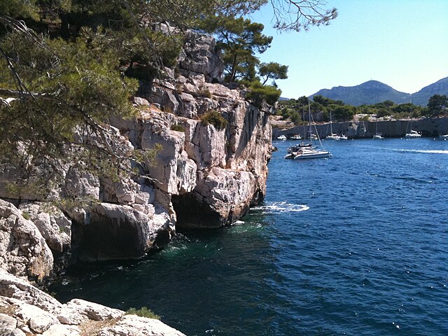
Français : Débouché sous-marin de l'exsurgence de Port-Miou English: Submarine output of the karst spring, "Port-Miou", Cassis, Marseille. Output of the upper karst spring of two submarine karst conduits, result of the complete desiccation of the Mediterranean Sea in late Miocene. Deutsch: Submarine Austrittsstelle der Karstquelle von "Port-Miou", Cassis bei Marseille. Dieser obere und ein tiefer als 223 m (Stand 2015) reichender Karstgang, entstanden wahrscheinlich während der "Messinischen Salinitätskrise" des späten Miozän. |
| Date | |
| Source | Own work |
| Author | Xerti |
| Other versions | Image:Bloc Port Miou-2.jpg |
| Camera location | | View this and other nearby images on: OpenStreetMap |
|---|
Photo réalisée avec iPhone 3G
Licensing
I, the copyright holder of this work, hereby publish it under the following licences:

|
Permission is granted to copy, distribute and/or modify this document under the terms of the GNU Free Documentation Licence, Version 1.2 or any later version published by the Free Software Foundation; with no Invariant Sections, no Front-Cover Texts, and no Back-Cover Texts. A copy of the licence is included in the section entitled GNU Free Documentation Licence. |
This file is licensed under the Creative Commons Attribution-Share Alike 3.0 Unported, 2.5 Generic, 2.0 Generic and 1.0 Generic licence.
- You are free:
- to share – to copy, distribute and transmit the work
- to remix – to adapt the work
- Under the following conditions:
- attribution – You must give appropriate credit, provide a link to the licence, and indicate if changes were made. You may do so in any reasonable manner, but not in any way that suggests the licensor endorses you or your use.
- share alike – If you remix, transform, or build upon the material, you must distribute your contributions under the same or compatible licence as the original.
You may select the licence of your choice.
File history
Click on a date/time to view the file as it appeared at that time.
| Date/Time | Thumbnail | Dimensions | User | Comment | |
|---|---|---|---|---|---|
| current | 21:05, 2 February 2011 | | 2,048 × 1,536 (1.4 MB) | wikimediacommons>Xerti | {{Information |Description ={{en|1=Submarine output of the Port-Miou underground river}} {{fr|1=Débouché sous-marin de l'exsurgence de Port-Miou}} |Source =Own work |Author =Xerti |Date =2010-08-16 |Permission = |other_v |
File usage
The following page uses this file: