Fresnes-sur-Escaut - Fosse Sarteau - Coupe verticale des puits n°1 et n°2.jpg
From Underfoot
Size of this preview: 268 × 600 pixels. Other resolutions: 107 × 240 pixels | 214 × 480 pixels | 343 × 768 pixels | 1,170 × 2,619 pixels.
Original file (1,170 × 2,619 pixels, file size: 846 KB, MIME type: image/jpeg)
Summary
| Description |
English:
Français :
|
| Date | between 1822 and 1867 |
| Source | Compagnie des mines d'Anzin |
| Author | Compagnie des mines d'Anzin |
| Camera location | | View this and other nearby images on: OpenStreetMap |
|---|
Licensing
|
This work is in the public domain in its country of origin and other countries and areas where the copyright term is the author's life plus 70 years or fewer. | |
| This file has been identified as being free of known restrictions under copyright law, including all related and neighbouring rights. | |
File history
Click on a date/time to view the file as it appeared at that time.
| Date/Time | Thumbnail | Dimensions | User | Comment | |
|---|---|---|---|---|---|
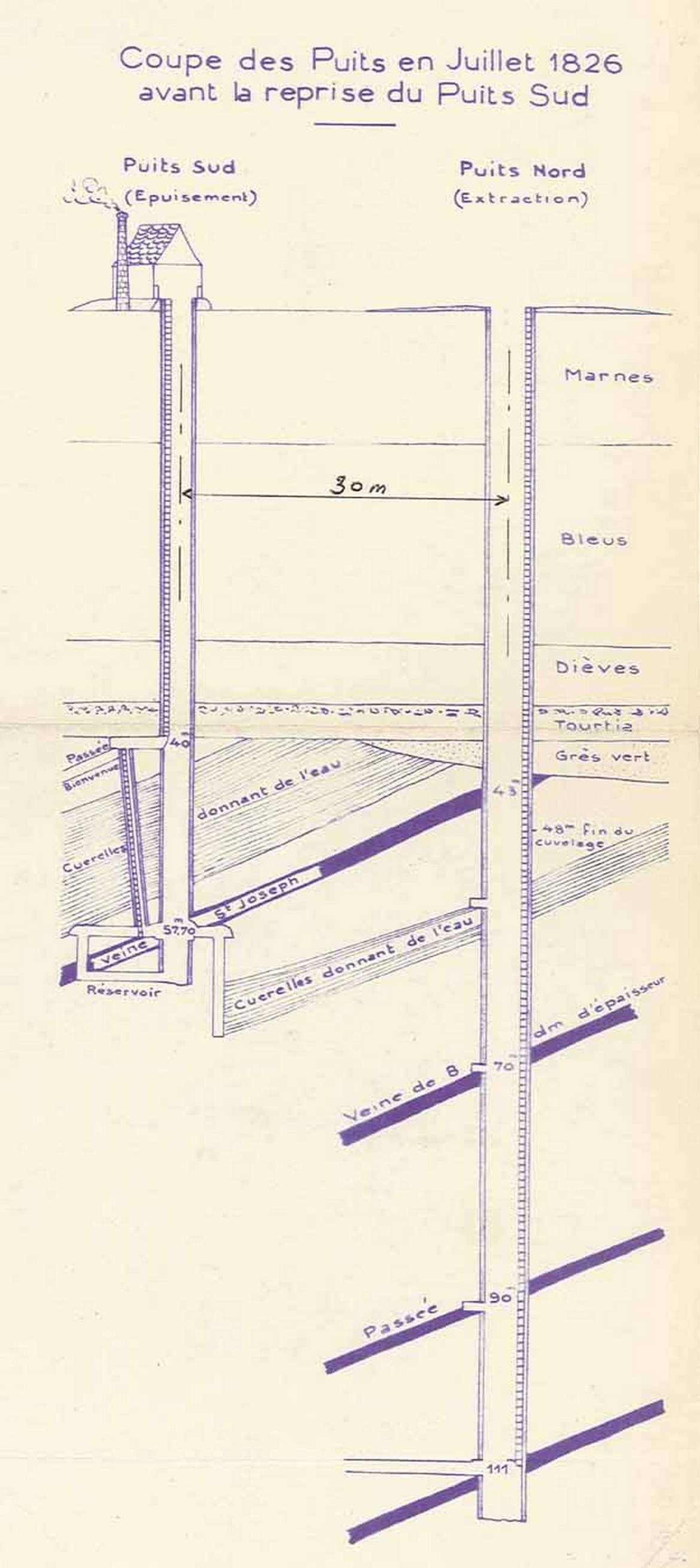
| current | 15:20, 1 March 2009 | | 1,170 × 2,619 (846 KB) | wikimediacommons>Jérémy-Günther-Heinz Jähnick | {{Information |Description={{en|1=* Pit Sarteau 1 : 1822-1867. * Pit Sarteau 2 : 1823-1860. *Fresnes-sur-Escaut}} {{fr|1=* Puits Sarteau 1 : 1822-1867. * Puits Sarteau 2 : 1823-1860. *[[:fr:Fresnes-sur-Escaut|Fresnes-sur-Esc |
File usage
There are no pages that use this file.