File:Garzweiler Germany O&K-excavator-RH12-01.jpg
From Underfoot
Original file (6,314 × 3,552 pixels, file size: 10.72 MB, MIME type: image/jpeg)
This file is from Wikimedia Commons and may be used by other projects. The description on its file description page there is shown below.
Summary
| DescriptionGarzweiler Germany O&K-excavator-RH12-01.jpg |
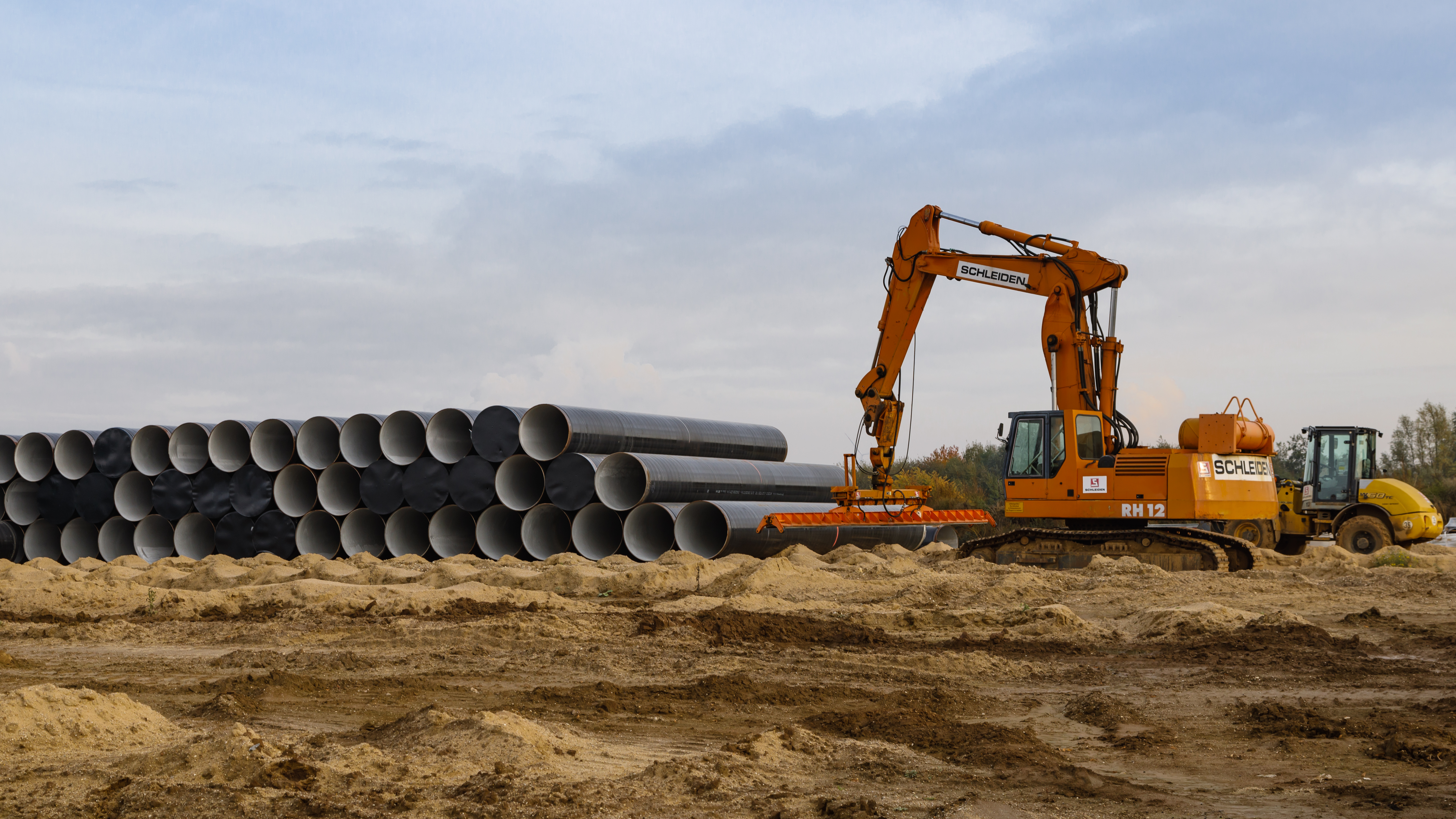
English: Garzweiler, Germany: O&K Excavator with tube handling device, ready to dig a ditch for pipeline installation |
|||
| Date | ||||
| Source | Own work | |||
| Author | CEphoto, Uwe Aranas | |||
| Permission (Reusing this file) |
|
|||
| Attribution (required by the licence) InfoField | Photo by CEphoto, Uwe Aranas / © CEphoto, Uwe Aranas (alternatively) |
|||
InfoField | Photo by CEphoto, Uwe Aranas | |||
| Camera location | 51° 02′ 34.2″ N, 6° 27′ 34.72″ E | View this and other nearby images on: OpenStreetMap |
|---|
| Object location | 51° 02′ 34.2″ N, 6° 27′ 34.72″ E | View this and other nearby images on: OpenStreetMap |
|---|
|
Do not upload new revisions over this file version without my explicit consent. Instead, use the possibility to upload a new version under a new name and tag it as a derivate or extract of this file. |
|
|
This image was reviewed by the author using the Quality image guidelines. This self-assessment is to certify, that: |
||
|
|
||
| If you think, that the image is not meeting the standards of the image guidelines, remove this tag and write the reason in the edit summary. | |||
Licensing
- You are free:
- to share – to copy, distribute and transmit the work
- to remix – to adapt the work
- Under the following conditions:
- attribution – You must give appropriate credit, provide a link to the licence, and indicate if changes were made. You may do so in any reasonable manner, but not in any way that suggests the licensor endorses you or your use.
- share alike – If you remix, transform, or build upon the material, you must distribute your contributions under the same or compatible licence as the original.
Captions
Items portrayed in this file
depicts
some value
1 November 2016
51°2'34.195"N, 6°27'34.722"E
51°2'34.1938"N, 6°27'34.7220"E
0.00625 second
50 millimetre
100
image/jpeg
File history
Click on a date/time to view the file as it appeared at that time.
| Date/Time | Thumbnail | Dimensions | User | Comment | |
|---|---|---|---|---|---|
| current | 12:02, 2 October 2017 | 6,314 × 3,552 (10.72 MB) | wikimediacommons>Cccefalon | =={{int:filedesc}}== {{Information |description={{en|1=Garzweiler, Germany: O&K Excavator with tube handling device, ready to dig a ditch for pipeline installation}} |date=2016-11-01 |source={{own}} |author=CEphoto, Uwe Aranas |permi... |
File usage
There are no pages that use this file.
Metadata
This file contains additional information, probably added from the digital camera or scanner used to create or digitise it.
If the file has been modified from its original state, some details may not fully reflect the modified file.
| Camera manufacturer | Canon |
|---|---|
| Camera model | Canon EOS 5D Mark IV |
| Author | Uwe Aranas |
| Exposure time | 1/160 sec (0.00625) |
| F Number | f/8 |
| ISO speed rating | 100 |
| Date and time of data generation | 14:47, 1 November 2016 |
| Lens focal length | 50 mm |
| Latitude | 51° 2′ 34.19″ N |
| Longitude | 6° 27′ 34.72″ E |
| Altitude | 108.4 metres above sea level |
| Online copyright statement | http://creativecommons.org/licenses/by-sa/3.0/ |
| Copyright holder |
|
| Usage terms |
|
| City shown | Titz |
| Horizontal resolution | 150 dpi |
| Vertical resolution | 150 dpi |
| Software used | Adobe Photoshop Lightroom 6.12 (Macintosh) |
| File change date and time | 18:06, 28 September 2017 |
| Exposure Program | Normal program |
| Exif version | 2.3 |
| Date and time of digitising | 14:47, 1 November 2016 |
| APEX shutter speed | 7.321928 |
| APEX aperture | 6 |
| APEX exposure bias | 0 |
| Maximum land aperture | 4 APEX (f/4) |
| Metering mode | Pattern |
| Flash | Flash did not fire, compulsory flash suppression |
| DateTimeDigitised subseconds | 00 |
| Colour space | sRGB |
| Focal plane X resolution | 1,866.6666564941 |
| Focal plane Y resolution | 1,866.6666564941 |
| Focal plane resolution unit | 3 |
| Custom image processing | Normal process |
| Exposure mode | Auto exposure |
| White balance | Auto white balance |
| Scene capture type | Standard |
| GPS time (atomic clock) | 13:46 |
| Satellites used for measurement | 7 |
| Receiver status | Measurement in progress |
| Measurement mode | 3-dimensional measurement |
| Measurement precision | Good (2.5) |
| Geodetic survey data used | WGS-84 |
| GPS date | 1 November 2016 |
| GPS tag version | 0.0.3.2 |
| Serial number of camera | 013021004012 |
| Lens used | EF24-105mm f/4L IS USM |
| Date metadata was last modified | 20:06, 28 September 2017 |
| Unique ID of original document | 31519EA39DBBC8A266053AEC7F18BF76 |
| Copyright status | Copyrighted |
| Contact information |
Bensberger Strasse 349 Rösrath, North Rhine-Westphalia, 51503 Germany |
| Province or state shown | Nordrhein-Westfalen |
| Country shown | Germany |
| Code for country shown | DE |
| IIM version | 4 |
