Iron box on moorland beside valley of Wager Burn (geograph 4722356).jpg
From Underfoot
Size of this preview: 800 × 600 pixels. Other resolutions: 320 × 240 pixels | 640 × 480 pixels | 1,024 × 768 pixels | 1,280 × 960 pixels | 1,500 × 1,125 pixels.
Original file (1,500 × 1,125 pixels, file size: 1.58 MB, MIME type: image/jpeg)
.jpg)
Summary
| Description |
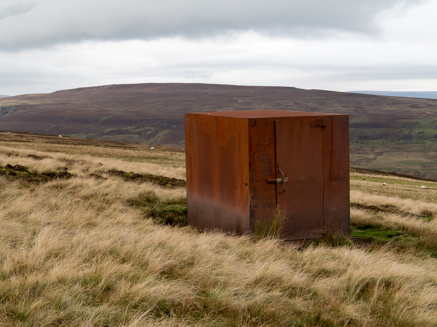
English: Iron box on moorland beside valley of Wager Burn. The box was presumably for small scale storage but seems to be disused currently. The valley of Wager Burn lies out of view, below, to the right. The distant hill is Catterick. |
| Date | |
| Source | From geograph.org.uk |
| Author | Trevor Littlewood |
| Permission (Reusing this file) |
Creative Commons Attribution Share-alike license 2.0 |
| Attribution (required by the licence) | Trevor Littlewood / Iron box on moorland beside valley of Wager Burn / |
| Camera location | | View this and other nearby images on: OpenStreetMap |
|---|
.jpg¶ms=054.701924_N_-001.981657_E_globe:Earth_type:camera_source:geograph-osgb36(NZ01283410)_heading:315.00&language=en-gb)
| Object location | | View this and other nearby images on: OpenStreetMap |
|---|
.jpg¶ms=054.702010_N_-001.981970_E_globe:Earth_class:object_type:object_source:geograph-osgb36(NZ01263411)_heading:315.00&language=en-gb)
Licensing

|
This image was taken from the Geograph GB & Eire project collection. See this photograph's page on the Geograph website for the photographer's contact details. The copyright on this image is owned by Trevor Littlewood, and is licensed for reuse under the Creative Commons Attribution Share-Alike 2.0 license.
|
This file is licensed under the Creative Commons Attribution-Share Alike 2.0 Generic licence.
Attribution:
Trevor Littlewood
- You are free:
- to share – to copy, distribute and transmit the work
- to remix – to adapt the work
- Under the following conditions:
- attribution – You must give appropriate credit, provide a link to the licence, and indicate if changes were made. You may do so in any reasonable manner, but not in any way that suggests the licensor endorses you or your use.
- share alike – If you remix, transform, or build upon the material, you must distribute your contributions under the same or compatible licence as the original.
File history
Click on a date/time to view the file as it appeared at that time.
| Date/Time | Thumbnail | Dimensions | User | Comment | |
|---|---|---|---|---|---|
| current | 00:03, 3 April 2019 | | 1,500 × 1,125 (1.58 MB) | wikimediacommons>NearEMPTiness | Transferred from geograph.co.uk using [https://tools.wmflabs.org/geograph2commons/ geograph2commons] |
File usage
There are no pages that use this file.
.jpg)