Kamp-Lintfort, Schachtanlage Rossenray, 2010-10 CN-02.jpg
From Underfoot

Size of this preview: 336 × 599 pixels. Other resolutions: 134 × 240 pixels | 269 × 480 pixels | 430 × 768 pixels | 574 × 1,024 pixels | 1,811 × 3,231 pixels.
Original file (1,811 × 3,231 pixels, file size: 3.19 MB, MIME type: image/jpeg)
| Description |
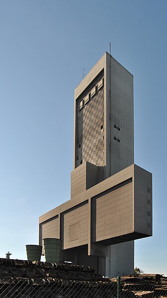
Deutsch: Kamp-Lintfort (Nordrhein-Westfalen) – Schachtanlage Rossenray (Verbundbergwerk West) – Schacht 1 – Förderturm (75 m hoch) – seitlicher Blick von Osten, Schacht 2 im Hintergrund
English: Kamp-Lintfort (North Rhine-Westphalia, Germany) – Rossenray Coal Mine – shaft 1 – winding tower (height: 75 m) – view from east, shaft 2 in the background
|
||
| Date | |||
| Source | Own work | ||
| Author | kaʁstn Disk/Cat | ||
| Permission (Reusing this file) |
I, the copyright holder of this work, hereby publish it under the following licences: This file is licensed under the Creative Commons Attribution-Share Alike 3.0 Germany licence.

You may select the licence of your choice. |
||
| Other versions |
|

| Camera location | | View this and other nearby images on: OpenStreetMap |
|---|
| This is a retouched picture, which means that it has been digitally altered from its original version. Modifications: perspective corrected. Modifications made by Carschten.
|
This image has been assessed using the Quality image guidelines and is considered a Quality image.
|
| Annotations | This image is annotated: View the annotations at Commons |
File history
Click on a date/time to view the file as it appeared at that time.
| Date/Time | Thumbnail | Dimensions | User | Comment | |
|---|---|---|---|---|---|
| current | 18:03, 21 April 2011 | | 1,811 × 3,231 (3.19 MB) | wikimediacommons>Carschten | new distortion correction |
File usage
There are no pages that use this file.