Karte Käpfnach 1899.jpg
From Underfoot

Original file (9,433 × 4,869 pixels, file size: 10.26 MB, MIME type: image/jpeg)
Summary
| Description |
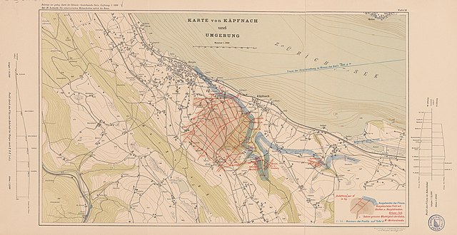
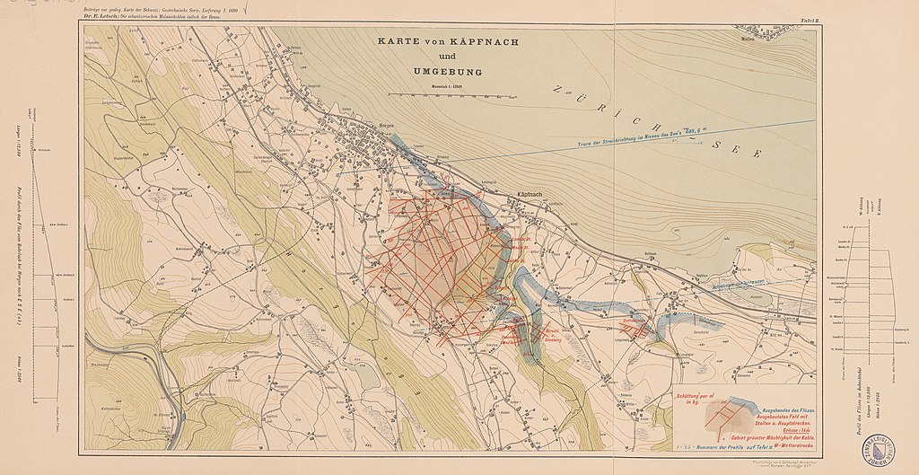
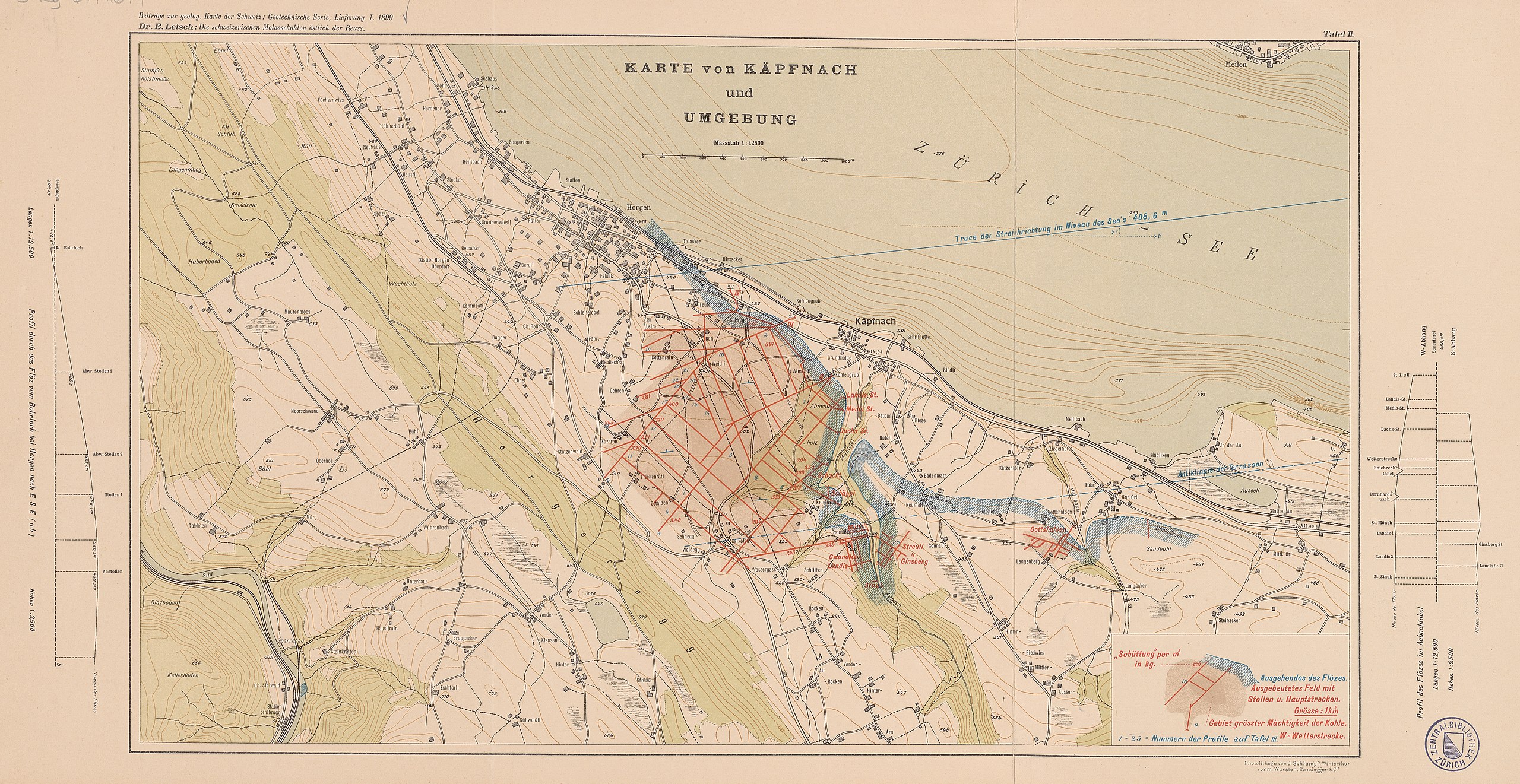
Deutsch: Karte von Käpfnach und Umgebung / E. Letsch ; Schweiz. Geol. Kommission: 1899 |
| Date | |
| Source |
DOI https://doi.org/10.3931/e-rara-26475 DOI https://doi.org/10.3931/e-rara-20722 |
| Author |
GESAMTTITEL Die schweizerischen Molassekohlen östlich der Reuss / von Emil Letsch TITEL Karte von Käpfnach und Umgebung / E. Letsch ; Schweiz. Geol. Kommission AUTOR, BETEILIGTE Letsch, Emil [1864-1949] IMPRESSUM Winterthur : J. Schlumpf, 1899 UMFANG 1 Karte : mehrfarbig ; 27 x 48 cm + Beiblatt SPRACHE Deutsch KARTENDATEN 1:12 500 (E 8°34'-E 8°38'/N 47°16'-N 47°14') BESITZENDE INSTITUTION Zentralbibliothek Zürich, 3 Ky 67: 16: 1 LIZENZ Public Domain Mark |
Licensing
|
This work is in the public domain in its country of origin and other countries and areas where the copyright term is the author's life plus 100 years or fewer. | |
| This file has been identified as being free of known restrictions under copyright law, including all related and neighbouring rights. | |
File history
Click on a date/time to view the file as it appeared at that time.
| Date/Time | Thumbnail | Dimensions | User | Comment | |
|---|---|---|---|---|---|
| current | 07:39, 30 June 2022 | | 9,433 × 4,869 (10.26 MB) | wikimediacommons>Paebi | Uploaded a work by GESAMTTITEL Die schweizerischen Molassekohlen östlich der Reuss / von Emil Letsch TITEL Karte von Käpfnach und Umgebung / E. Letsch ; Schweiz. Geol. Kommission AUTOR, BETEILIGTE Letsch, Emil [1864-1949] IMPRESSUM Winterthur : J. Schlumpf, 1899 UMFANG 1 Karte : mehrfarbig ; 27 x 48 cm + Beiblatt SPRACHE Deutsch KARTENDATEN 1:12 500 (E 8°34'-E 8°38'/N 47°16'-N 47°14') BESITZENDE INSTITUTION Zentralbibliothek Zürich, 3 Ky 67: 16: 1 LIZENZ Public Domain Mark from DOI https://... |
File usage
There are no pages that use this file.