Kvalsundtunnelen Sign P1.jpg
From Underfoot

Size of this preview: 800 × 533 pixels. Other resolutions: 320 × 213 pixels | 640 × 427 pixels | 1,024 × 683 pixels | 1,280 × 853 pixels | 2,560 × 1,707 pixels | 3,888 × 2,592 pixels.
Original file (3,888 × 2,592 pixels, file size: 2.45 MB, MIME type: image/jpeg)
Summary
| Description |
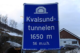
English: The road sign to the undersea road tunnel Kvalsundtunnelen on riksvei 863 (Norwegian national road 863), Norway. In the background you can see the entrace to the tunnel on the island Kvaløya.
Norsk bokmål: Veiskiltet til den undersjøiske veitunnelen Kvalsundtunnelen på Rv863. I Bakgrunnen kan man se innslaget til tunnelen på Kvaløya. |
| Date | |
| Source | Own work |
| Author | Snurre86 |
| Camera location | | View this and other nearby images on: OpenStreetMap |
|---|
Licensing
I, the copyright holder of this work, hereby publish it under the following licences:

|
Permission is granted to copy, distribute and/or modify this document under the terms of the GNU Free Documentation Licence, Version 1.2 or any later version published by the Free Software Foundation; with no Invariant Sections, no Front-Cover Texts, and no Back-Cover Texts. A copy of the licence is included in the section entitled GNU Free Documentation Licence. |
This file is licensed under the Creative Commons Attribution-Share Alike 3.0 Unported, 2.5 Generic, 2.0 Generic and 1.0 Generic licence.
- You are free:
- to share – to copy, distribute and transmit the work
- to remix – to adapt the work
- Under the following conditions:
- attribution – You must give appropriate credit, provide a link to the licence, and indicate if changes were made. You may do so in any reasonable manner, but not in any way that suggests the licensor endorses you or your use.
- share alike – If you remix, transform, or build upon the material, you must distribute your contributions under the same or compatible licence as the original.
You may select the licence of your choice.
File history
Click on a date/time to view the file as it appeared at that time.
| Date/Time | Thumbnail | Dimensions | User | Comment | |
|---|---|---|---|---|---|
| current | 23:03, 29 April 2009 | | 3,888 × 2,592 (2.45 MB) | wikimediacommons>Snurre86 | {{Information |Description={{en|1=Karlsundtunnelen - Roadsign}} {{no|1=Karlsundtunnelen - Veiskilt}} |Source=Opplasters eget arbeid (uploader's own work) |Author=Snurre86 |Date=29. April 2009 |Permission= |other_versions= }} <!--{{Image |
File usage
There are no pages that use this file.