Låvisberget Fv 50.JPG
From Underfoot

Size of this preview: 548 × 600 pixels. Other resolutions: 219 × 240 pixels | 439 × 480 pixels | 702 × 768 pixels | 936 × 1,024 pixels | 1,970 × 2,156 pixels.
Original file (1,970 × 2,156 pixels, file size: 843 KB, MIME type: image/jpeg)
Summary
| Description |
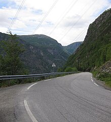
English: Låvisberget hill on Fylkesveg 50 (road 50), Aurland. Lange tunnel (hairpin tunnel) in the distance. 407 meters above sea level |
| Date | |
| Source | Own work |
| Author | Erik den yngre |
| Camera location | | View this and other nearby images on: OpenStreetMap |
|---|
Licensing
I, the copyright holder of this work, hereby publish it under the following licence:
This file is licensed under the Creative Commons Attribution-Share Alike 3.0 Unported licence.
- You are free:
- to share – to copy, distribute and transmit the work
- to remix – to adapt the work
- Under the following conditions:
- attribution – You must give appropriate credit, provide a link to the licence, and indicate if changes were made. You may do so in any reasonable manner, but not in any way that suggests the licensor endorses you or your use.
- share alike – If you remix, transform, or build upon the material, you must distribute your contributions under the same or compatible licence as the original.
File history
Click on a date/time to view the file as it appeared at that time.
| Date/Time | Thumbnail | Dimensions | User | Comment | |
|---|---|---|---|---|---|
| current | 16:42, 25 August 2012 | | 1,970 × 2,156 (843 KB) | wikimediacommons>Erik den yngre | User created page with UploadWizard |
File usage
The following 6 pages use this file: