Ludesch-Zementwerk-Steinbruch-Raumplanung-119690.jpg
From Underfoot

Size of this preview: 800 × 532 pixels. Other resolutions: 320 × 213 pixels | 640 × 426 pixels | 1,024 × 681 pixels | 1,280 × 851 pixels | 3,008 × 2,000 pixels.
Original file (3,008 × 2,000 pixels, file size: 1.2 MB, MIME type: image/jpeg)
Summary
| Description |
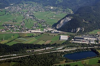
Deutsch: Steinbruch und ehemalige Zementfabrik in Ludesch, Vorarlberg, Österreich.
English: Quarry and former Cement factory in Ludesch, Vorarlberg, Austria.
Français : Carrière et ancien Usine de ciment à Ludesch, Vorarlberg, Autriche. |
| Date | |
| Source | https://pid.volare.vorarlberg.at/o:119690 |
| Author | Raumplanung/Land Vorarlberg |
| Object location | | View this and other nearby images on: OpenStreetMap |
|---|
Licensing
This image is available from the collection Schrägluftbilder of the Vorarlberger Landesbibliothek under the id 119690.
|
volare – Vorarlberger Landesrepositorium |
This file is licensed under the Creative Commons Attribution-Share Alike 4.0 International licence.
Attribution:
Foto: Raumplanung/Land Vorarlberg
- You are free:
- to share – to copy, distribute and transmit the work
- to remix – to adapt the work
- Under the following conditions:
- attribution – You must give appropriate credit, provide a link to the licence, and indicate if changes were made. You may do so in any reasonable manner, but not in any way that suggests the licensor endorses you or your use.
- share alike – If you remix, transform, or build upon the material, you must distribute your contributions under the same or compatible licence as the original.
File history
Click on a date/time to view the file as it appeared at that time.
| Date/Time | Thumbnail | Dimensions | User | Comment | |
|---|---|---|---|---|---|
| current | 12:02, 19 May 2020 | | 3,008 × 2,000 (1.2 MB) | wikimediacommons>Asurnipal | Uploaded a work by Raumplanung/Land Vorarlberg from Foto: Raumplanung/Land Vorarlberg Permalink: https://pid.volare.vorarlberg.at/o:119690 with UploadWizard |
File usage
There are no pages that use this file.