Munt la Schera Tunnel.jpg
From Underfoot
Size of this preview: 800 × 600 pixels. Other resolutions: 320 × 240 pixels | 640 × 480 pixels | 1,024 × 768 pixels | 1,280 × 960 pixels | 1,600 × 1,200 pixels.
Original file (1,600 × 1,200 pixels, file size: 688 KB, MIME type: image/jpeg)
| Description |
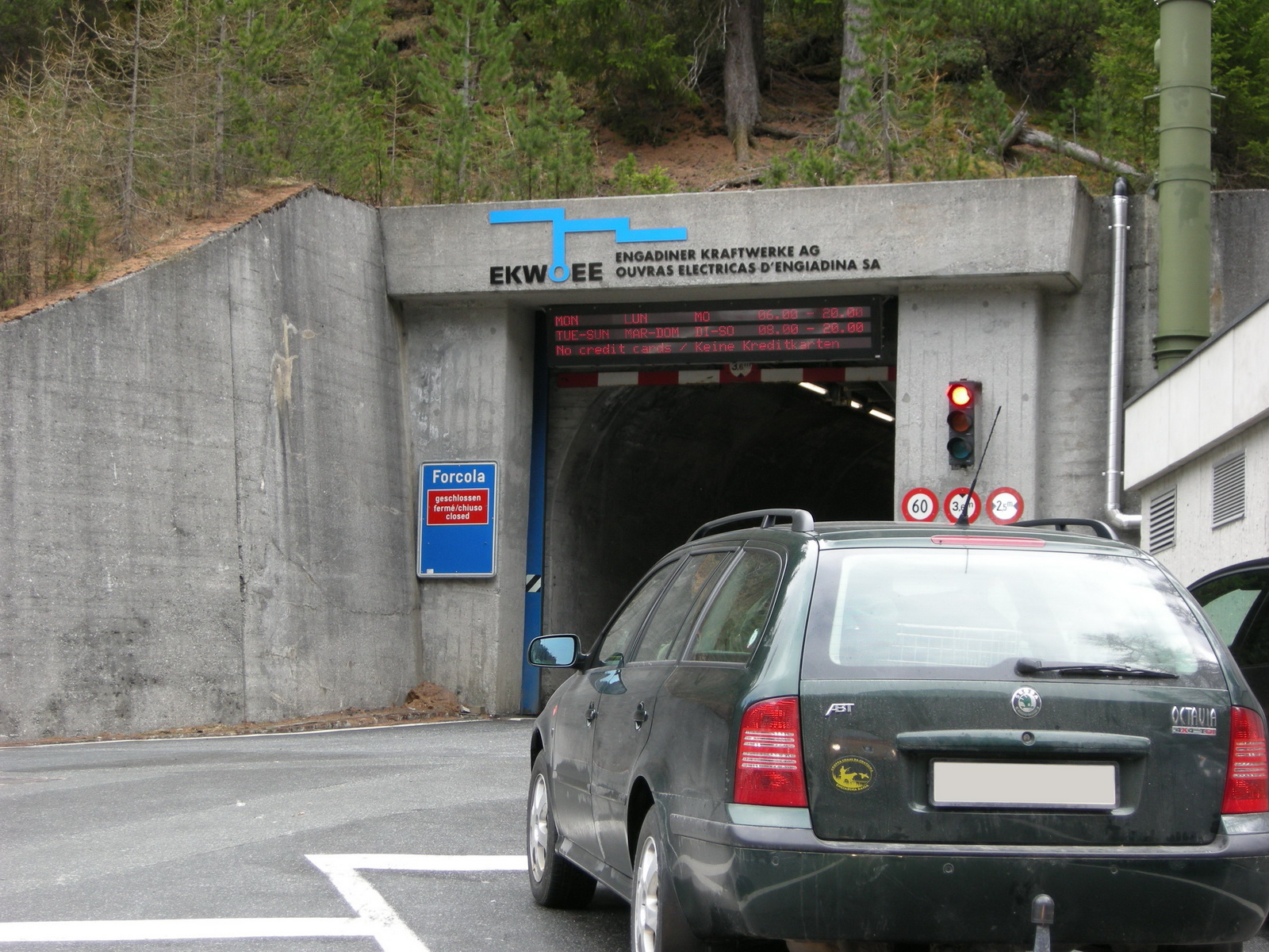
Italiano: Entrata settentrionale al Tunnel Munt la Schera, tra Zernez e Livigno. Tunnel costruito dalla società idroelettrica svizzera Engadiner Kraft Werk per la realizzazione della diga dall'altra parte della valle che ha dato origine al Lago del Gallo o di Livigno. Aperto al traffico nel 1969 resta di proprietà dell'azienda costruttrice a cui si paga il pedaggio. Essendo stato realizzato per la costruzione di una diga e non per il traffico veicolare è lungo, diritto e stretto, largo una corsia e pertanto regolato da un semaforo di senso unico alternato
Deutsch: Der Munt la Schera Tunnel wurde von den Engadiner Kraftwerken als Zugang zum Staudammprojekt Punt dall Gall gebaut. 1969 wurde der Tunnel für den allgemeinen Strassenverkehr geöffnet, er kann nur im Einbahnverkehr und gegen Bezahlung einer Durchfahrtsgebühr an die Eigentümerin befahren werden. |
||
| Date | |||
| Source | originally posted to Flickr as Munt la Schera Tunnel | ||
| Author | mstefano80 | ||
| Permission (Reusing this file) |
This file is licensed under the Creative Commons Attribution-Share Alike 2.0 Generic licence.
|
| Object location | | View this and other nearby images on: OpenStreetMap |
|---|
File history
Click on a date/time to view the file as it appeared at that time.
| Date/Time | Thumbnail | Dimensions | User | Comment | |
|---|---|---|---|---|---|
| current | 17:23, 18 November 2008 | | 1,600 × 1,200 (688 KB) | wikimediacommons>Flickr upload bot | Uploaded from http://flickr.com/photo/12111034@N03/2485570911 using Flickr upload bot |
File usage
There are no pages that use this file.