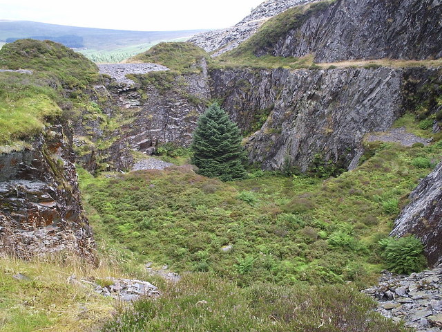
Pit at Rosebush slate quarry - geograph.org.uk - 293408.jpg
From Underfoot
File:Pit at Rosebush slate quarry - geograph.org.uk - 293408.jpg
No higher resolution available.
Pit_at_Rosebush_slate_quarry_-_geograph.org.uk_-_293408.jpg (640 × 480 pixels, file size: 155 KB, MIME type: image/jpeg)
File history
Click on a date/time to view the file as it appeared at that time.
| Date/Time | Thumbnail | Dimensions | User | Comment | |
|---|---|---|---|---|---|
| current | 21:42, 14 December 2010 | | 640 × 480 (155 KB) | wikimediacommons>GeographBot | == {{int:filedesc}} == {{Information |description={{en|1=Pit at Rosebush slate quarry This pit is the deepest part of the southern working of the quarry, with a further 5 levels above. It was drained by an adit. The quarry was opened 1842 and reached its |
File usage
The following 2 pages use this file: