Potočka zijalka.jpg
From Underfoot

Size of this preview: 800 × 600 pixels. Other resolutions: 320 × 240 pixels | 640 × 480 pixels | 1,024 × 768 pixels | 1,280 × 960 pixels | 2,048 × 1,536 pixels.
Original file (2,048 × 1,536 pixels, file size: 1.48 MB, MIME type: image/jpeg)
Summary
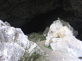
| Description | Potočka zijalka entry |
| Date | |
| Source | Potočka zijalka |
| Author | poldek_tedy |
| Camera location | | View this and other nearby images on: OpenStreetMap |
|---|
Licensing
This file is licensed under the Creative Commons Attribution-Share Alike 3.0 Unported licence.
- You are free:
- to share – to copy, distribute and transmit the work
- to remix – to adapt the work
- Under the following conditions:
- attribution – You must give appropriate credit, provide a link to the licence, and indicate if changes were made. You may do so in any reasonable manner, but not in any way that suggests the licensor endorses you or your use.
- share alike – If you remix, transform, or build upon the material, you must distribute your contributions under the same or compatible licence as the original.
| This image, which was originally posted to Panoramio, was reviewed on 24 August 2011 by the administrator or trusted user Hoangquan hientrang, who confirmed that it was available on Panoramio under the above license on that date. |

|
The usage of reproductions of the cultural monuments No. 541 for commercial purposes is restricted by the Slovenian Cultural Heritage Protection Act, which requires a consensus of the owner of the monument for any use of image and name of the monument (article 44). Wikimedia Commons is not required to comply as it is hosted in the United States of America. Users who are citizens of Slovenia are warned that they are solely responsible for any possible violation of local laws. See our general disclaimer for more information. These restrictions are independent of the copyright status of the depicted work.
The definition of a cultural monument is the following (article 3): heritage, which has been statutorily protected as a monument or entered in the inventory of an authorised museum. As much as it concerns immovable cultural heritage, the national catalog is publicly accessible at gisportal.gov.si.
|
File history
Click on a date/time to view the file as it appeared at that time.
| Date/Time | Thumbnail | Dimensions | User | Comment | |
|---|---|---|---|---|---|
| current | 20:46, 18 February 2013 | | 2,048 × 1,536 (1.48 MB) | wikimediacommons>TadejM | Reverted to version as of 10:13, 23 August 2011; per COM:CROP; a substantial crop that should be uploaded as a separate file |
File usage
There are no pages that use this file.