Rusty railway (40362173602).jpg
From Underfoot
Original file (2,760 × 3,680 pixels, file size: 5.59 MB, MIME type: image/jpeg)
This file is from Wikimedia Commons and may be used by other projects. The description on its file description page there is shown below.
Summary
| DescriptionRusty railway (40362173602).jpg |
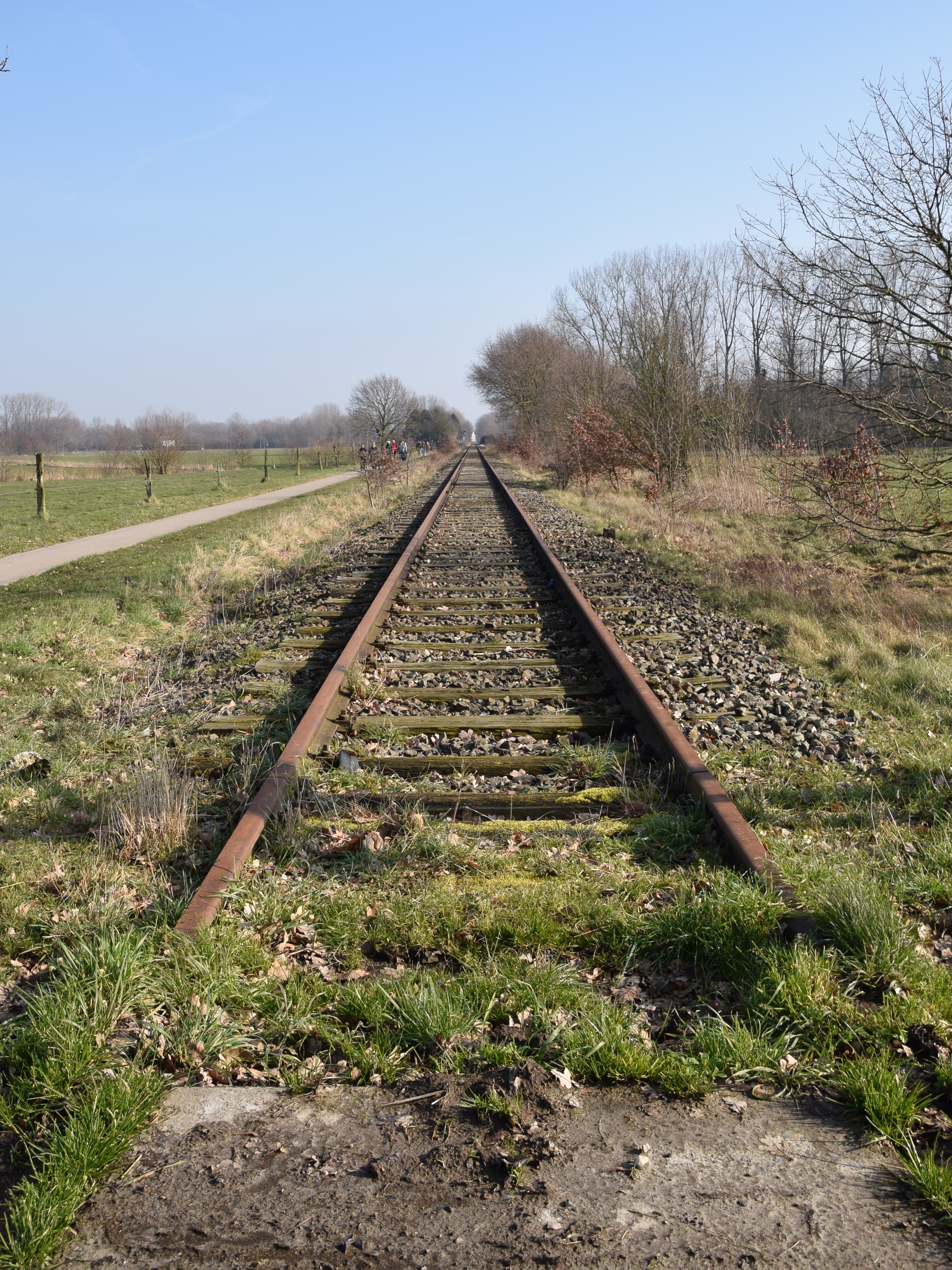
Oorspronkelijk was dit NMBS spoorlijn 52 Dendermonde – Antwerpen-zuid. In 1980 werd het gewone treinverkeer opgeheven tussen Baasrode en Puurs. Op dit gedeelte is er enkel nog toeristische exploitatie: op zomerse zondagen wordt de spoorlijn bereden door het historisch materieel van de vereniging Stoomtrein Dendermonde-Puurs. Once this was Belgian SNCB railway n° 52 (Dendermonde - Antwerp). In 1980 regular train traffic was discontinued between Baasrode and Puurs. Nowadays this section only has a touristic exploitation: the local Steam Train Association uses the track on summer Sundays with their historical material. (<a href="http://www.stoomtrein.be" rel="nofollow">www.stoomtrein.be</a>). |
| Date | |
| Source | Rusty railway |
| Author | Luc.T from Buggenhout, België |
| Camera location | 51° 04′ 26.45″ N, 4° 15′ 31.26″ E | View this and other nearby images on: OpenStreetMap |
|---|
Licensing
- You are free:
- to share – to copy, distribute and transmit the work
- to remix – to adapt the work
- Under the following conditions:
- attribution – You must give appropriate credit, provide a link to the licence, and indicate if changes were made. You may do so in any reasonable manner, but not in any way that suggests the licensor endorses you or your use.
| This image was originally posted to Flickr by Luc.T at https://flickr.com/photos/65015316@N07/40362173602. It was reviewed on 5 August 2021 by FlickreviewR 2 and was confirmed to be licensed under the terms of the cc-by-2.0. |
5 August 2021
Captions
Items portrayed in this file
depicts
18 February 2018
51°4'26.447"N, 4°15'31.259"E
0.0025 second
18 millimetre
400
image/jpeg
File history
Click on a date/time to view the file as it appeared at that time.
| Date/Time | Thumbnail | Dimensions | User | Comment | |
|---|---|---|---|---|---|
| current | 07:52, 5 August 2021 | 2,760 × 3,680 (5.59 MB) | wikimediacommons>1Veertje | Transferred from Flickr via #flickr2commons |
File usage
There are no pages that use this file.
Metadata
This file contains additional information, probably added from the digital camera or scanner used to create or digitise it.
If the file has been modified from its original state, some details may not fully reflect the modified file.
| Camera manufacturer | NIKON CORPORATION |
|---|---|
| Camera model | NIKON D3300 |
| Exposure time | 1/400 sec (0.0025) |
| F Number | f/9 |
| ISO speed rating | 400 |
| Date and time of data generation | 12:01, 18 February 2018 |
| Lens focal length | 18 mm |
| Latitude | 51° 4′ 26.45″ N |
| Longitude | 4° 15′ 31.26″ E |
| Altitude | 9.75 metres above sea level |
| City shown | Sint-Amands Oppuurs |
| Orientation | Normal |
| Horizontal resolution | 300 dpi |
| Vertical resolution | 300 dpi |
| Software used | Ver.1.01 |
| File change date and time | 12:01, 18 February 2018 |
| Y and C positioning | Centred |
| Exposure Program | Aperture priority |
| Exif version | 2.3 |
| Date and time of digitising | 12:01, 18 February 2018 |
| Meaning of each component |
|
| Image compression mode | 4 |
| APEX exposure bias | 0.33333333333333 |
| Maximum land aperture | 3.6 APEX (f/3.48) |
| Metering mode | Pattern |
| Light source | Fine weather |
| Flash | Flash did not fire |
| DateTime subseconds | 40 |
| DateTimeOriginal subseconds | 40 |
| DateTimeDigitised subseconds | 40 |
| Supported Flashpix version | 1 |
| Colour space | sRGB |
| Sensing method | One-chip colour area sensor |
| File source | Digital still camera |
| Scene type | A directly photographed image |
| Custom image processing | Normal process |
| Exposure mode | Auto exposure |
| White balance | Manual white balance |
| Digital zoom ratio | 1 |
| Focal length in 35 mm film | 27 mm |
| Scene capture type | Standard |
| Scene control | Low gain up |
| Contrast | Normal |
| Saturation | Normal |
| Sharpness | Normal |
| Subject distance range | Unknown |
| GPS time (atomic clock) | 11:01 |
| Geodetic survey data used | WGS-84 |
| GPS date | 18 February 2018 |
| GPS tag version | 0.0.2.2 |
| Keywords |
|
| Sublocation of city shown | Meir |
| Province or state shown | Vlaanderen |
| Code for country shown | BEL |
| Country shown | Belgium |
| IIM version | 4 |