Skip loader (8894869798).jpg
From Underfoot
Size of this preview: 800 × 531 pixels. Other resolutions: 320 × 213 pixels | 640 × 425 pixels | 1,024 × 680 pixels | 1,280 × 850 pixels | 2,560 × 1,700 pixels | 3,216 × 2,136 pixels.
Original file (3,216 × 2,136 pixels, file size: 4.92 MB, MIME type: image/jpeg)
.jpg)
Summary
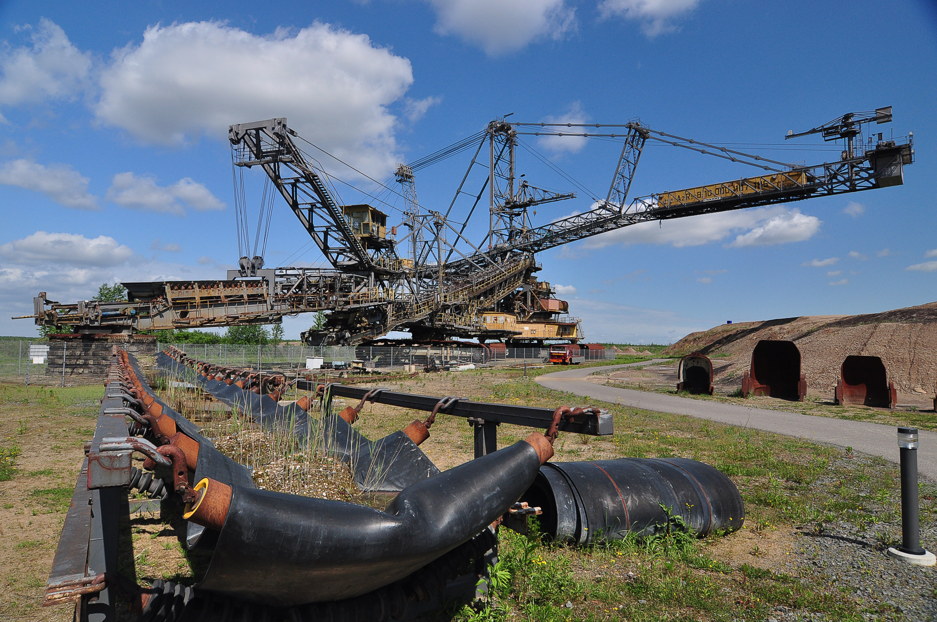
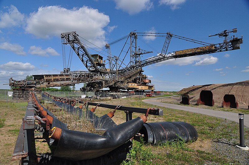
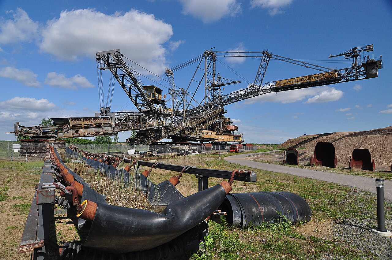
| Description | The Central German area was dominated by the centuries-long extraction, refining and use of natural resource lignite. But in the early nineties came in the wake of reunification and therefore changing energy policy, the collapse-like end of this era. |
| Date | |
| Source | Skip loader |
| Author | b3tarev3 from England |
| Camera location | | View this and other nearby images on: OpenStreetMap |
|---|
.jpg¶ms=051.247545_N_0012.427639_E_globe:Earth_type:camera_source:Flickr_&language=en-gb)
Licensing
This work has been released into the public domain by the author on Flickr, where the author has declared it as a "Public Domain Work" and tagged it with the Creative Commons Public Domain Mark.
|
||
The Public Domain Mark (PDM) is not a copyright license, but a symbol used to indicate that a work is in the public domain. When it is applied by the author or the copyright holder, community consensus has decided such works as being public domain in the US and countries where it is legally possible to release own work to the public domain. In the countries where this is not possible, the copyright status of the work remains undetermined.
| ||
If a file is tagged with Public Domain Mark by someone other than the author or the copyright holder, a more specific copyright tag such as one found at Commons:Copyright tags/General public domain must be applied. If this is your own work, please use {{Cc-zero}} instead.
|
| This image was originally posted to Flickr by b3tarev3 at https://flickr.com/photos/28310050@N02/8894869798. It was reviewed on 19 December 2021 by FlickreviewR 2 and was confirmed to be licensed under the terms of the Public Domain Mark. |
File history
Click on a date/time to view the file as it appeared at that time.
| Date/Time | Thumbnail | Dimensions | User | Comment | |
|---|---|---|---|---|---|
| current | 16:17, 19 December 2021 | | 3,216 × 2,136 (4.92 MB) | wikimediacommons>Siloepic | Transferred from Flickr via #flickr2commons |
File usage
There are no pages that use this file.
.jpg)