Stemmer Berg-Eckerde-Schacht IV.jpg
From Underfoot

Size of this preview: 799 × 219 pixels. Other resolutions: 320 × 88 pixels | 640 × 175 pixels | 1,024 × 281 pixels | 1,280 × 351 pixels | 3,940 × 1,080 pixels.
Original file (3,940 × 1,080 pixels, file size: 2.63 MB, MIME type: image/jpeg)
Summary
| Description |
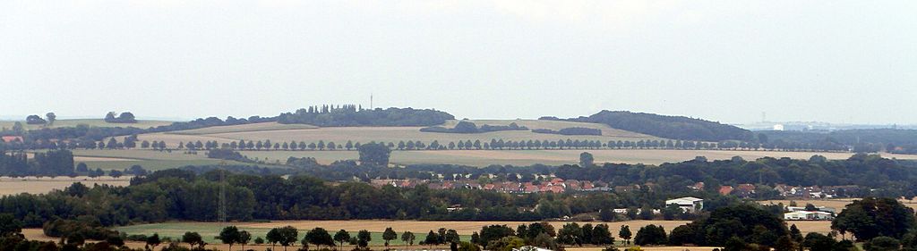
Deutsch: Blick vom Gipfel der Bergehalde im Zechenpark Barsinghausen in Richtung Stemmer Berg über Schacht IV und Eckerde |
| Date | |
| Source | Own work |
| Author | Den man tau |
| Camera location | | View this and other nearby images on: OpenStreetMap |
|---|
Licensing
I, the copyright holder of this work, hereby publish it under the following licence:
This file is licensed under the Creative Commons Attribution-Share Alike 4.0 International licence.
- You are free:
- to share – to copy, distribute and transmit the work
- to remix – to adapt the work
- Under the following conditions:
- attribution – You must give appropriate credit, provide a link to the licence, and indicate if changes were made. You may do so in any reasonable manner, but not in any way that suggests the licensor endorses you or your use.
- share alike – If you remix, transform, or build upon the material, you must distribute your contributions under the same or compatible licence as the original.
File history
Click on a date/time to view the file as it appeared at that time.
| Date/Time | Thumbnail | Dimensions | User | Comment | |
|---|---|---|---|---|---|
| current | 20:13, 24 August 2016 | 3,940 × 1,080 (2.63 MB) | wikimediacommons>Den man tau | User created page with UploadWizard |
File usage
There are no pages that use this file.