souterrain
From Underfoot
Q137937
Souterrain, meaning "subterrain", is a name given by archaeologists to a type of underground structure associated mainly with the European Atlantic Iron Age.
Wikimedia, Wikidata
Eirde house; Pict's house; Picts' houses; earth house; earth houses; souterrain (archaeology)
underground structure,
-
Location: KML, Cluster Map, Maps,
 Earth house Crichton Mains Anderson 1883 scotlandinpagant00andeiala 0327
 Earth house Newstead Anderson 1883 scotlandinpagant00andeiala 0326
 Earth house Cairn Conan Anderson 1883 scotlandinpagant00andeiala 0320
 Earth house Migvie Anderson 1883 scotlandinpagant00andeiala 0310
 Plan and section of earth-house near Durness
 Earth House Eriboll Anderson 1883 scotlandinpagant00andeiala 0315
 Souterrains aan een kade, RP-P-1902-A-22521
 @souterrain ginasservis 1905
 Earth-house near Durness - Map of locality
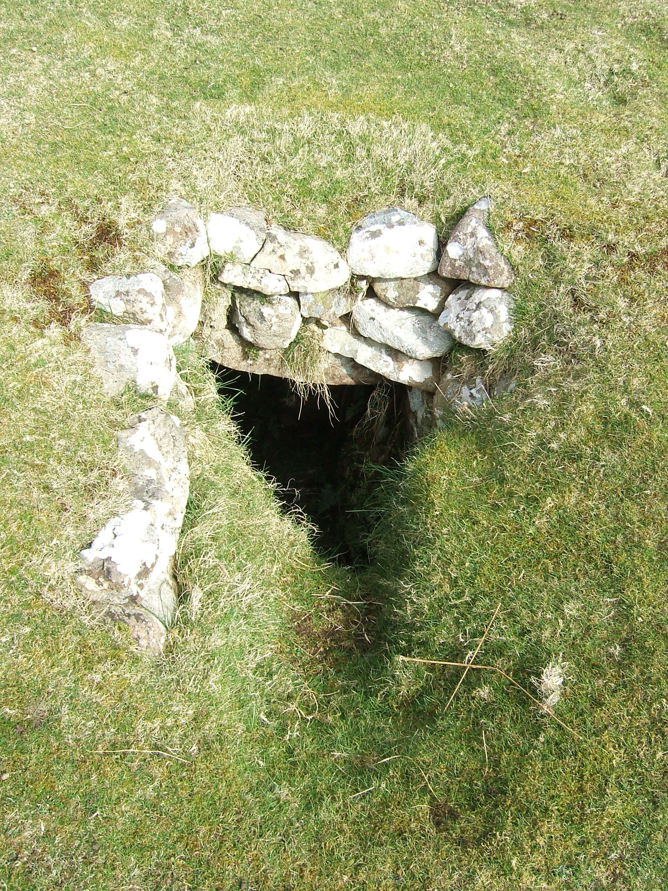 Neolithic souterrain Canna Island
- Les souterrains aménagés de la France au Moyen Âge - scholarly article in Archéologie Médiévale, vol. 8 no. 1, 1978, Q150
- Die mittelalterlichen souterrains in Frankreich - article published in 1979
- The Excavation of a House and Souterrain at Craig Hill, Co. Antrim - article published in 1956
- Drumadoon, County Antrim — an early house and souterrain - article published in 2015
| Type | Subtype | Date | Description | Notes | Source |
|---|---|---|---|---|---|
| commons | image | Earth house Crichton Mains Anderson 1883 scotlandinpagant00andeiala 0327 | Commons | ||
| commons | image | Earth house Newstead Anderson 1883 scotlandinpagant00andeiala 0326 | Commons | ||
| commons | image | Earth house Cairn Conan Anderson 1883 scotlandinpagant00andeiala 0320 | Commons | ||
| commons | image | Earth house Migvie Anderson 1883 scotlandinpagant00andeiala 0310 | Commons | ||
| commons | image | Plan and section of earth-house near Durness | Commons | ||
| commons | image | Earth House Eriboll Anderson 1883 scotlandinpagant00andeiala 0315 | Commons | ||
| commons | image | Souterrains aan een kade, RP-P-1902-A-22521 | Commons | ||
| commons | image | @souterrain ginasservis 1905 | Commons | ||
| commons | image | Earth-house near Durness - Map of locality | Commons | ||
| commons | image | Neolithic souterrain Canna Island | Commons | ||