tunnel of aggression
From Underfoot
Q16187491
The Korean Demilitarized Zone is a heavily militarized strip of land running across the Korean Peninsula near the 38th parallel north. The demilitarized zone (DMZ) is a border barrier that divides the peninsula roughly in half. It was established to serve as a buffer zone between the sovereign states of the Democratic People's Republic of Korea and the Republic of Korea under the provisions of the Korean Armistice Agreement in 1953, an agreement between North Korea, China, and the United Nations Command.
Wikimedia, Wikidata
Korean infilteration tunnel; tunnel of invasion
tunnel, international tunnel,
-
Location: 38.3167, 127.2333, KML, Cluster Map, Maps,
1 places
-

Third Tunnel of Aggression ⓘ
one of four known tunnels located under the border between North Korea and South Korea
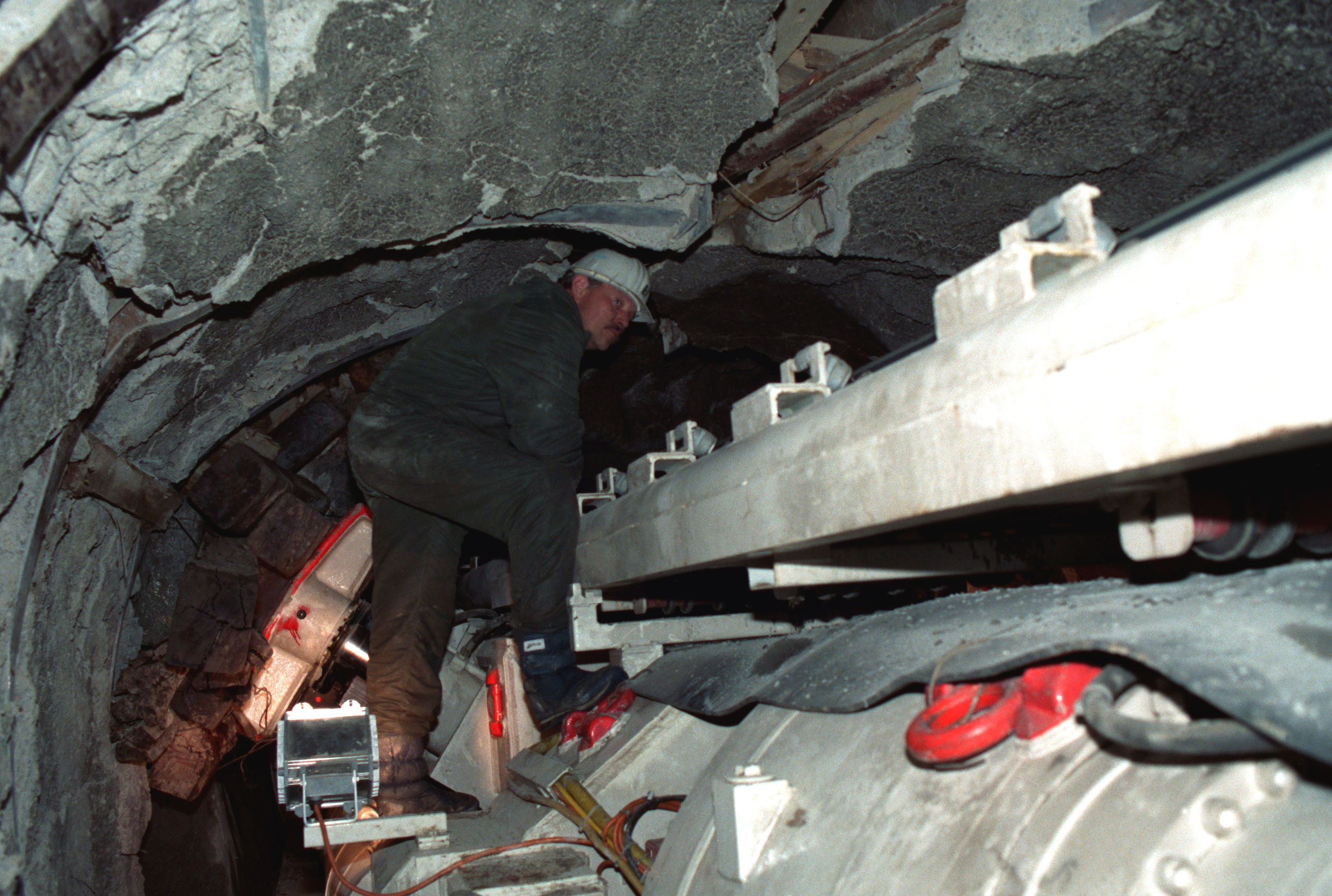 South Korean counter-tunnel (1990)South Korean counter-tunnel (1990)
 Entrance to the 4th Infiltration Tunnel, Korean DMZEntrance to the 4th Infiltration Tunnel, Korean DMZ
 DMZ 2596
 DMZ 2597
| Type | Subtype | Date | Description | Notes | Source |
|---|---|---|---|---|---|
| site | tunnel | Third Tunnel of Aggression | tunnel of aggression | Wikidata | |
| commons | image | South Korean counter-tunnel (1990) | Commons | ||
| commons | image | South Korean counter-tunnel (1990) | Commons | ||
| commons | image | Entrance to the 4th Infiltration Tunnel, Korean DMZ | Commons | ||
| commons | image | Entrance to the 4th Infiltration Tunnel, Korean DMZ | Commons | ||
| commons | image | DMZ 2596 | Commons | ||
| commons | image | DMZ 2597 | Commons | ||
.JPEG)