former Bertholène mine
From Underfoot
Q61937986
Q61937986
former uranium mine
-
Location: 44.3859, 2.7619, KML, Cluster Map, Maps,
3 places
-
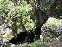
Tindoul de la Vayssière ⓘ
-
Tindoul de la Vayssière ⓘ
-

former Bertholène mine ⓘ
former uranium mine
| Type | Subtype | Date | Description | Notes | Source |
|---|---|---|---|---|---|
| site | cave | Tindoul de la Vayssière | pit cave | Wikidata | |
| site | cave | Tindoul de la Vayssière | pit cave | Wikidata | |
| site | mine | former Bertholène mine | uranium mine | Wikidata | |