Heiligenwaldsee
From Underfoot
lake in Germany

-
Location: 49.1209, 10.9895, KML, Cluster Map, Maps,
59 places
-

Cultural heritage D-1-7033-0024 in Titting ⓘ
cultural heritage monument in Titting, Eichstätt, Upper Bavaria, Bavaria, Germany -
Cultural heritage D-1-7132-0057 in Dollnstein ⓘ
cultural heritage monument in Dollnstein, Eichstätt, Upper Bavaria, Bavaria, Germany -
Cultural heritage D-1-7132-0068 in Dollnstein ⓘ
cultural heritage monument in Dollnstein, Eichstätt, Upper Bavaria, Bavaria, Germany -
Cultural heritage D-1-7132-0071 in Dollnstein ⓘ
cultural heritage monument in Dollnstein, Eichstätt, Upper Bavaria, Bavaria, Germany -
Cultural heritage D-1-7132-0080 in Mörnsheim ⓘ
cultural heritage monument in Mörnsheim, Eichstätt, Upper Bavaria, Bavaria, Germany -
Cultural heritage D-5-6933-0009 in Greding ⓘ
cultural heritage monument in Landkreis Landkreis Roth in Bavaria, Germany -
Cultural heritage D-5-7032-0059 in Raitenbuch ⓘ
cultural heritage monument in Raitenbuch, Weißenburg-Gunzenhausen, Middle Franconia, Bavaria, Germany -
Doline mit Schacht im Schernfelder Forst ⓘ
Geotop in Landkreis Eichstätt in Bavaria, Germany -

Grubschwart ⓘ
cave in Germany -
Höhle Grafsloch bei Mörnsheim-Altendorf ⓘ
Geotop in Landkreis Eichstätt in Bavaria, Germany -

Höhlensystem am Euerwanger Bühl ⓘ
-

Hohlloch ⓘ
cave in Germany -

Mühlfelsen N der Bubenrother Mühle ⓘ
Geotop in Landkreis Eichstätt in Bavaria, Germany -

Osterdorfer Löcher ⓘ
doline in Germany -
Pulverhöhle bei Breitenfurt ⓘ
Geotop in Landkreis Eichstätt in Bavaria, Germany -

Pumperhöhle ⓘ
cave in Bavaria -
Pumperloch E von Otting ⓘ
Geotop in Landkreis Donau-Ries in Bavaria, Germany -
Teufelshöhle W von Bieswang ⓘ
Geotop in Landkreis Weißenburg-Gunzenhausen in Bavaria, Germany -
Aufgelassener Steinbruch E von Ursheim ⓘ
Geotop in Landkreis Weißenburg-Gunzenhausen in Bavaria, Germany -

Ehem. Juramarmorbruch Stiegler NW von Solnhofen ⓘ
Geotop in Landkreis Weißenburg-Gunzenhausen in Bavaria, Germany -
Ehem. Steinbruch Wasserzell am Frauenberg bei Eichstätt ⓘ
Geotop in Landkreis Eichstätt in Bavaria, Germany -
Ehemaliger Plattenkalkbruch Kesseltal am Solnhofener Berg ⓘ
Geotop in Landkreis Eichstätt in Bavaria, Germany -
Ehemaliger Steinbruch am Steigweg bei Obereichstätt ⓘ
Geotop in Landkreis Eichstätt in Bavaria, Germany -
Ehemaliger Steinbruch N von Osterdorf ⓘ
Geotop in Landkreis Weißenburg-Gunzenhausen in Bavaria, Germany -
Ehemaliger Steinbruch N von Rübling ⓘ
Geotop in Landkreis Neumarkt i.d.OPf. in Bavaria, Germany -
Ehemaliger Steinbruch NE von Hürth ⓘ
Geotop in Landkreis Weißenburg-Gunzenhausen in Bavaria, Germany -

Ehemaliger Steinbruch NE von Kühedorf ⓘ
-
Ehemaliger Steinbruch nordöstlich von Stahlmühle ⓘ
Geotop in Landkreis Weißenburg-Gunzenhausen in Bavaria, Germany -
Ehemaliger Steinbruch S von Rothenstein ⓘ
Geotop in Landkreis Weißenburg-Gunzenhausen in Bavaria, Germany -

Ehemaliger Steinbruch SE von Weißenburg ⓘ
Geotop in Landkreis Weißenburg-Gunzenhausen in Bavaria, Germany -
Ehemaliger Steinbruch SW von Bieswang ⓘ
Geotop in Landkreis Weißenburg-Gunzenhausen in Bavaria, Germany -

Ehemaliger Steinbruch SW von Greding ⓘ
Geotop in Landkreis Roth in Bavaria, Germany -
Ehemaliger Steinbruch SW von Petersbuch ⓘ
Geotop in Landkreis Eichstätt in Bavaria, Germany -
Ehemaliger Steinbruch W von Götzenreuth ⓘ
Geotop in Landkreis Roth in Bavaria, Germany -
Ehemaliger Steinbruch W von Osterdorf ⓘ
Geotop in Landkreis Weißenburg-Gunzenhausen in Bavaria, Germany -
Ehemaliger Steinbruch WNW von Offenbau ⓘ
Geotop in Landkreis Roth in Bavaria, Germany -

Elefantenschlucht ⓘ
former quarry in Germany -

Fossilien-Besuchersteinbruch Mühlheim ⓘ
Geotop in Landkreis Eichstätt in Bavaria, Germany -

Heiligenwaldsee ⓘ
lake in Germany -
Hobbysteinbruch ESE von Langenaltheim ⓘ
Geotop in Landkreis Weißenburg-Gunzenhausen in Bavaria, Germany -

Holsteinbruch ⓘ
former settlement in Nuremberg -

Steinbruch Langenaltheimer Haardt ⓘ
-
Steinbruch W von Fuchsmühle ⓘ
Geotop in Landkreis Weißenburg-Gunzenhausen in Bavaria, Germany -

Steinbrüche NE von Obereichstätt ⓘ
Geotop in Landkreis Eichstätt in Bavaria, Germany -

Steinbrüche von Wernsbach ⓘ
quarry in Germany -
Steinbruchgebiet am Schrandelberg SE von Langenaltheim ⓘ
Geotop in Landkreis Weißenburg-Gunzenhausen in Bavaria, Germany -

Wernloch ⓘ
former quarry in Germany -
Eisenbahntunnel durch den Kirchenberg ⓘ
-
Eisenbahnunterführung Bahnlinie Nördlingen - Pleinfeld in Pleinfeld ⓘ
cultural heritage monument D-5-77-161-142 (1) in Pleinfeld, Bavaria -

Esslingerbergtunnel ⓘ
-

Euerwangtunnel ⓘ
railway tunnel in Germany -
Fußgängertunnel Bahnlinie Nördlingen - Pleinfeld in Gunzenhausen ⓘ
cultural heritage monument D-5-77-136-236 (2) in Gunzenhausen, Bavaria -

Kirchberg-Tunnel ⓘ
railway tunnel in Bavaria -
Kirchbergtunnel ⓘ
-

Offenbau Tunnel ⓘ
-
Tunnel Bahnlinie Nördlingen - Pleinfeld in Gunzenhausen ⓘ
cultural heritage monument D-5-77-136-237 (2) in Gunzenhausen, Bavaria -
Tunnel Bahnlinie Nördlingen - Pleinfeld in Haundorf ⓘ
cultural heritage monument D-5-77-136-229 (2) in Haundorf, Bavaria -
Tunnel Bahnlinie Nördlingen - Pleinfeld in Pfofeld ⓘ
cultural heritage monument D-5-77-136-229 (3) in Pfofeld, Bavaria -

Göggelsbuchtunnel ⓘ
railway tunnel in Germany
{"selectable":false,"showCurrentTime":false,"width":"100%","zoomMin":100000000000}
 aerial photograph of Brombachsee and Roettenbach
 Heiligenwaldsee
 Heiligenwaldsee
 Heiligenwaldsee
 Heiligenwaldsee
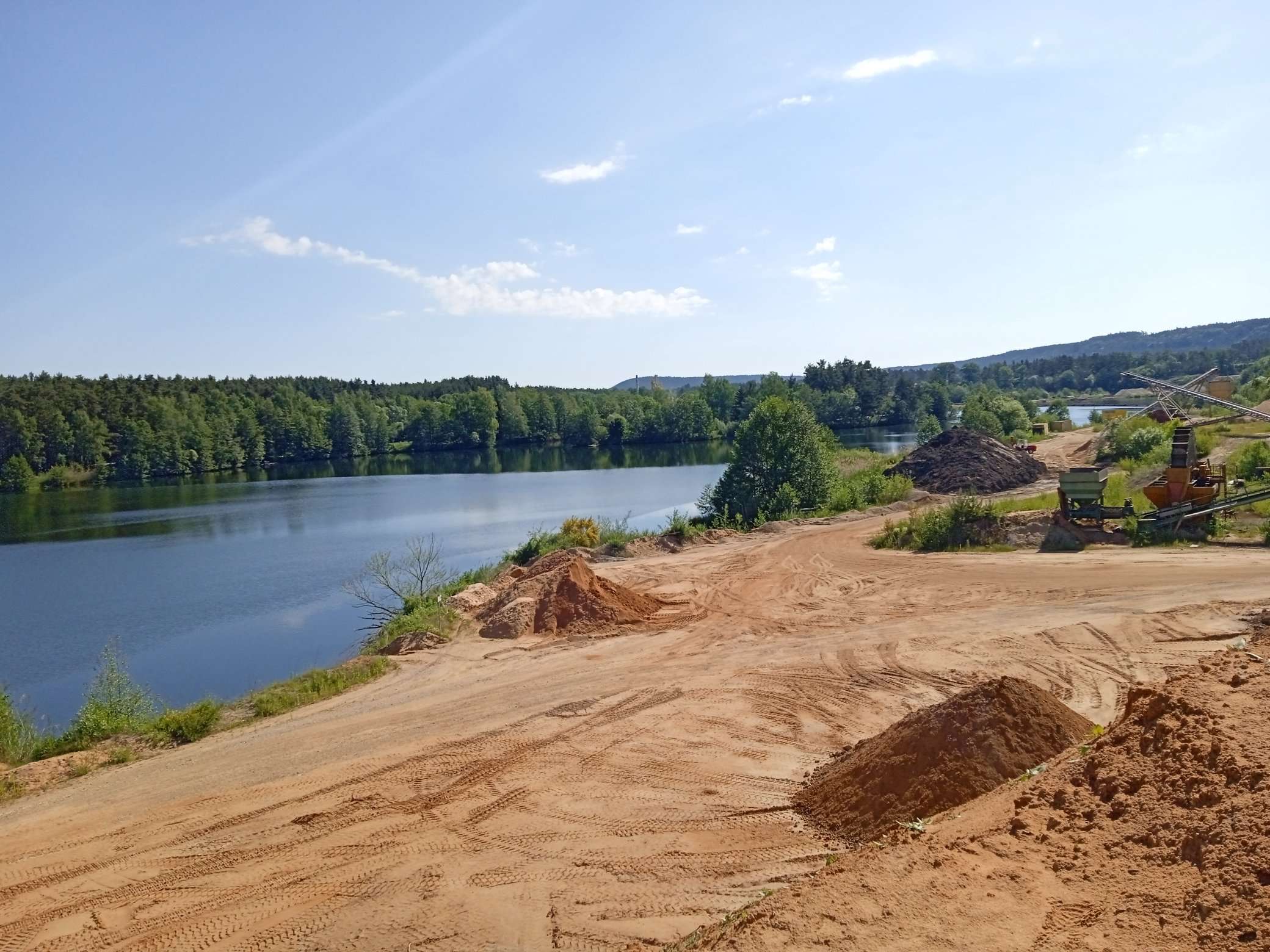 Heiligenwaldsee
 Heiligenwaldsee
 HeiligenwaldseeHeiligenwaldseeHeiligenwaldsee
| Type | Subtype | Date | Description | Notes | Source |
|---|---|---|---|---|---|
| site | cave | Cultural heritage D-1-7033-0024 in Titting | Bodendenkmal, cave | Wikidata | |
| site | cave | Cultural heritage D-1-7132-0057 in Dollnstein | inhabited cave, Bodendenkmal, cave | Wikidata | |
| site | cave | Cultural heritage D-1-7132-0068 in Dollnstein | inhabited cave, Bodendenkmal, cave | Wikidata | |
| site | cave | Cultural heritage D-1-7132-0071 in Dollnstein | inhabited cave, Bodendenkmal, cave | Wikidata | |
| site | cave | Cultural heritage D-1-7132-0080 in Mörnsheim | Bodendenkmal, cave | Wikidata | |
| site | cave | Cultural heritage D-5-6933-0009 in Greding | Bodendenkmal, cave | Wikidata | |
| site | cave | Cultural heritage D-5-7032-0059 in Raitenbuch | Bodendenkmal, cave | Wikidata | |
| site | cave | Doline mit Schacht im Schernfelder Forst | pit cave, geotope, doline | Wikidata | |
| site | cave | Grubschwart | horizontal cave, pinge, geotope, adit, cave | Wikidata | |
| site | cave | Höhle Grafsloch bei Mörnsheim-Altendorf | geotope, cave | Wikidata | |
| site | cave | Höhlensystem am Euerwanger Bühl | horizontal cave, geotope, cave | Wikidata | |
| site | cave | Hohlloch | horizontal cave, natural monument in Germany, geotope, cave | Wikidata | |
| site | cave | Mühlfelsen N der Bubenrother Mühle | horizontal cave, rock pinnacle, geotope | Wikidata | |
| site | cave | Osterdorfer Löcher | pit cave, pinge, geotope, doline | Wikidata | |
| site | cave | Pulverhöhle bei Breitenfurt | horizontal cave, geotope | Wikidata | |
| site | cave | Pumperhöhle | cave | Wikidata | |
| site | cave | Pumperloch E von Otting | natural monument in Germany, geotope, cave | Wikidata | |
| site | cave | Teufelshöhle W von Bieswang | geotope, cave | Wikidata | |
| site | mine | Aufgelassener Steinbruch E von Ursheim | geotope, quarry | Wikidata | |
| site | mine | Ehem. Juramarmorbruch Stiegler NW von Solnhofen | geotope, quarry | Wikidata | |
| site | mine | Ehem. Steinbruch Wasserzell am Frauenberg bei Eichstätt | geotope, quarry | Wikidata | |
| site | mine | Ehemaliger Plattenkalkbruch Kesseltal am Solnhofener Berg | geotope, quarry | Wikidata | |
| site | mine | Ehemaliger Steinbruch am Steigweg bei Obereichstätt | natural monument in Germany, geotope, quarry | Wikidata | |
| site | mine | Ehemaliger Steinbruch N von Osterdorf | geotope, quarry | Wikidata | |
| site | mine | Ehemaliger Steinbruch N von Rübling | geotope, quarry | Wikidata | |
| site | mine | Ehemaliger Steinbruch NE von Hürth | geotope, quarry | Wikidata | |
| site | mine | Ehemaliger Steinbruch NE von Kühedorf | geotope, rock, quarry | Wikidata | |
| site | mine | Ehemaliger Steinbruch nordöstlich von Stahlmühle | geotope, quarry | Wikidata | |
| site | mine | Ehemaliger Steinbruch S von Rothenstein | geotope, quarry | Wikidata | |
| site | mine | Ehemaliger Steinbruch SE von Weißenburg | geotope, quarry | Wikidata | |
| site | mine | Ehemaliger Steinbruch SW von Bieswang | geotope, quarry | Wikidata | |
| site | mine | Ehemaliger Steinbruch SW von Greding | geotope, quarry | Wikidata | |
| site | mine | Ehemaliger Steinbruch SW von Petersbuch | geotope, quarry | Wikidata | |
| site | mine | Ehemaliger Steinbruch W von Götzenreuth | geotope, quarry | Wikidata | |
| site | mine | Ehemaliger Steinbruch W von Osterdorf | geotope, quarry | Wikidata | |
| site | mine | Ehemaliger Steinbruch WNW von Offenbau | geotope, quarry | Wikidata | |
| site | mine | Elefantenschlucht | stone quarry | Wikidata | |
| site | mine | Fossilien-Besuchersteinbruch Mühlheim | geotope, quarry | Wikidata | |
| site | mine | Heiligenwaldsee | quarry lake, lake | Wikidata | |
| site | mine | Hobbysteinbruch ESE von Langenaltheim | geotope, quarry | Wikidata | |
| site | mine | Holsteinbruch | former settlement, natural monument in Germany, isolated settlement, Ortsteil, quarry | Wikidata | |
| site | mine | Steinbruch Langenaltheimer Haardt | type locality, geotope, quarry, fossil | Wikidata | |
| site | mine | Steinbruch W von Fuchsmühle | geotope, quarry | Wikidata | |
| site | mine | Steinbrüche NE von Obereichstätt | soil series, geotope, rock, quarry | Wikidata | |
| site | mine | Steinbrüche von Wernsbach | rock, geotope, quarry, adit | Wikidata | |
| site | mine | Steinbruchgebiet am Schrandelberg SE von Langenaltheim | geotope, quarry | Wikidata | |
| site | mine | Wernloch | stone quarry, Bodendenkmal | Wikidata | |
| site | tunnel | Eisenbahntunnel durch den Kirchenberg | railway tunnel | Wikidata | |
| site | tunnel | Eisenbahnunterführung Bahnlinie Nördlingen - Pleinfeld in Pleinfeld | subway | Wikidata | |
| site | tunnel | Esslingerbergtunnel | railway tunnel, DB Netz | Wikidata | |
| site | tunnel | Euerwangtunnel | railway tunnel, DB Netz | Wikidata | |
| site | tunnel | Fußgängertunnel Bahnlinie Nördlingen - Pleinfeld in Gunzenhausen | tunnel | Wikidata | |
| site | tunnel | Kirchberg-Tunnel | DB InfraGO, railway tunnel | Wikidata | |
| site | tunnel | Kirchbergtunnel | railway tunnel, DB Netz | Wikidata | |
| site | tunnel | Offenbau Tunnel | railway tunnel | Wikidata | |
| site | tunnel | Tunnel Bahnlinie Nördlingen - Pleinfeld in Gunzenhausen | tunnel | Wikidata | |
| site | tunnel | Tunnel Bahnlinie Nördlingen - Pleinfeld in Haundorf | tunnel | Wikidata | |
| site | tunnel | Tunnel Bahnlinie Nördlingen - Pleinfeld in Pfofeld | tunnel | Wikidata | |
| site | tunnel | 2001 | Göggelsbuchtunnel | railway tunnel, DB Netz | Wikidata |
| commons | image | aerial photograph of Brombachsee and Roettenbach | Commons | ||
| commons | image | Heiligenwaldsee | Commons | ||
| commons | image | Heiligenwaldsee | Commons | ||
| commons | image | Heiligenwaldsee | Commons | ||
| commons | image | Heiligenwaldsee | Commons | ||
| commons | image | Heiligenwaldsee | Commons | ||
| commons | image | Heiligenwaldsee | Commons | ||
| commons | image | Heiligenwaldsee | Commons | ||
| commons | image | Heiligenwaldsee | Commons | ||
| commons | image | Heiligenwaldsee | Commons | ||
Rummage summary