Fort Henry
From Underfoot
Q5471318
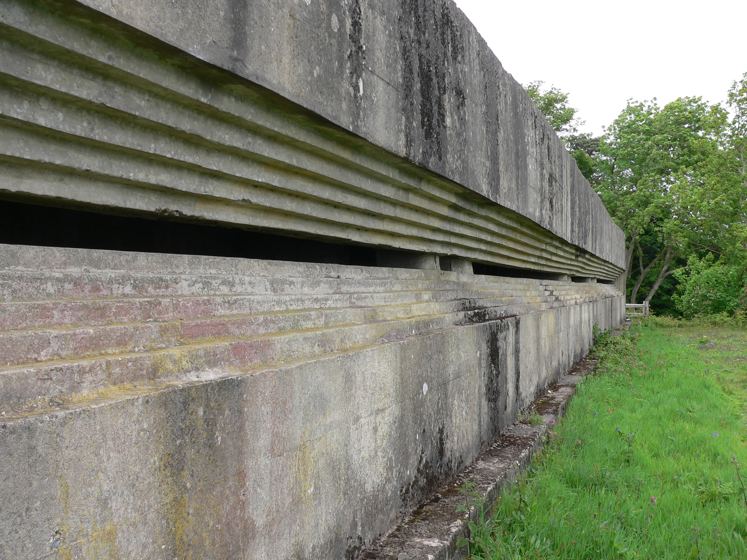
Fort Henry is a Grade II listed World War Two observation bunker overlooking Studland Bay, in Dorset. It was built in 1943 to defend the bay from possible German invasion along with other beach defences such as gun emplacements, Type 25 pill boxes and concrete Dragon’s Teeth anti-tank obstacles.
Wikimedia, Wikidata
United Kingdom, 
-
Location: 50.6452, -1.9478, KML, Cluster Map, Maps,
12 places
-

Christchurch Hampshire County Council and County Borough of Bournemouth Area Control ⓘ
civil defence centre in Hampshire, UK -

Fort Henry ⓘ
bunker in Studland, Dorset, UK -

Grotto 250 Metres South East Of St Giles House ⓘ
grotto in Wimborne St Giles, Dorset, England, UK -
Grotto In Grounds Of Rempstone Hall, 90 Metres North North East Of Rempstone Hall ⓘ
grotto in Corfe Castle, Purbeck, Dorset, England, UK -
Grotto Or Rock Bridge, 400 Metres South South East Of Encombe House ⓘ
grotto in Corfe Castle, Purbeck, Dorset, England, UK -
Parson's Barn ⓘ
Cave at the South-Coast of England -

Tilly Whim Caves ⓘ
caves in Dorset, England -
Belle Vue Quarry ⓘ
Site of Special Scientific Interest in Dorset -

Blue Pool ⓘ
lake in Dorset, England, UK -
Lacey's Farm Quarry ⓘ
quarry in the UK -

Winspit ⓘ
quarry on the Isle of Purbeck, Dorset, England -

Purbeck Mining Museum ⓘ
museum near Corfe Castle, Dorset, England, UK
{"selectable":false,"showCurrentTime":false,"width":"100%","zoomMin":100000000000}
 Fort Henry BunkerFort Henry Bunker
 Bunker in Studland (2529)
 Bunker in Studland (2523)
 Bunker in Studland (2528)
 Studland: Fort Henry and Exercise Smash (2)
 Studland: Fort Henry and Exercise Smash (6)
 Studland: Fort Henry and Exercise Smash (4)
 Studland: Fort Henry and Exercise Smash (5)
 Memorial commemorating soldiers killed when tanks sank during a training excercise in WW2.
.jpg)
.jpg)
.jpg)
_-_geograph.org.uk_-_3744057.jpg)
_-_geograph.org.uk_-_3744102.jpg)
_-_geograph.org.uk_-_3744078.jpg)
_-_geograph.org.uk_-_3744090.jpg)