Lyttelton road tunnel
From Underfoot
Q6710403
The Lyttelton road tunnel runs through the Port Hills to connect the New Zealand city of Christchurch and its seaport, Lyttelton. It opened in on 27 February 1964 and carries just over 10,000 vehicles per day as part of State Highway 74.
Wikimedia, Wikidata
New Zealand,

link={{{3}}}
New Zealand,
.jpg)
-
Location: -43.5942, 172.7116, KML, Cluster Map, Maps,
6 places
-

Barnett Park Cave ⓘ
Large cave above Barnett Park in Redcliffs, Christchurch -

Cracroft Caverns ⓘ
cave in New Zealand -

Moncks Cave ⓘ
cave located in Redcliffs, Christchurch -
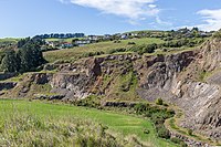
Halswell Quarry ⓘ
former quarry in Canterbury, New Zealand -

Lyttelton Rail Tunnel ⓘ
railway tunnel -

Lyttelton road tunnel ⓘ
road tunnel in Christchurch, New Zealand
 Lyttelton Tunnel portal, Canterbury, New Zealand, 28 May 2008
 Lyttelton Tunnel (South Entrance)1
 Lyttelton Tunnel (South Entrance)
 Inside Lyttelton Tunnel (North Entrance)
 Lyttelton Tunnel (North Entrance)
 Lyttelton tunnel1
| Type | Subtype | Date | Description | Notes | Source |
|---|---|---|---|---|---|
| site | cave | Barnett Park Cave | geographic location, cave | Wikidata | |
| site | cave | Cracroft Caverns | Christchurch City Council, cave | Wikidata | |
| site | cave | Moncks Cave | geographic location, cave | Wikidata | |
| site | mine | Halswell Quarry | quarry | Wikidata | |
| site | tunnel | Lyttelton Rail Tunnel | KiwiRail, railway tunnel | Wikidata | |
| site | tunnel | Lyttelton road tunnel | tunnel | Wikidata | |
| commons | image | Lyttelton Tunnel portal, Canterbury, New Zealand, 28 May 2008 | Commons | ||
| commons | image | Lyttelton Tunnel (South Entrance)1 | Commons | ||
| commons | image | Lyttelton Tunnel (South Entrance) | Commons | ||
| commons | image | Inside Lyttelton Tunnel (North Entrance) | Commons | ||
| commons | image | Lyttelton Tunnel (North Entrance) | Commons | ||
| commons | image | Lyttelton tunnel1 | Commons | ||
1.jpg)
.jpg)
.jpg)