Ehemalige Abbaustellen am Kleinenzenrieder Pfahl
From Underfoot
Q59244791
Q59244791
Geotop in Landkreis Cham in Bavaria, Germany
-
Location: 49.3211, 12.532, KML, Cluster Map, Maps,
77 places
-

Munitionsbunker Ponnholz in Arnschwang ⓘ
cultural heritage monument D-3-72-112-32 (2) in Arnschwang, Bavaria -
Munitionsbunker Ponnholz in Arnschwang ⓘ
cultural heritage monument D-3-72-112-32 (3) in Arnschwang, Bavaria -

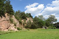
Burgberg Falkenstein ⓘ
Geotop in Landkreis Cham in Bavaria, Germany -

Hohler Stein am Burgberg NW von Falkenstein ⓘ
Geotop in Landkreis Cham in Bavaria, Germany -
Lourdesgrotte Weidenthal 26 in Guteneck ⓘ
cultural heritage monument D-3-76-133-13 (2) in Guteneck, Bavaria -
Mariengrotte Heilbrünnl 2 in Roding ⓘ
cultural heritage monument D-3-72-153-47 (2) in Roding, Bavaria -
Salka ⓘ
cave in Czech Republic -
Asbestloch beim Ochsenberg bei Rimbach ⓘ
Geotop in Landkreis Cham in Bavaria, Germany -
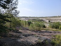
Braunkohletagebau südlich Wackersdorf ⓘ
-
Ehem. Gneisbruch am Refberg NE von Refthal ⓘ
Geotop in Landkreis Regensburg in Bavaria, Germany -
Ehem. Granitsteinbrüche SE von Gleiritsch ⓘ
Geotop in Landkreis Schwandorf in Bavaria, Germany -
Ehem. Steinbruch am Blätterberg SE von Furth im Wald ⓘ
Geotop in Landkreis Cham in Bavaria, Germany -
Ehem. Steinbruch am Ochsenberg NE von Zell ⓘ
Geotop in Landkreis Cham in Bavaria, Germany -
Ehem. Steinbruch am Pfahl des Schwärzenbergs NW von Strahlfeld ⓘ
Geotop in Landkreis Cham in Bavaria, Germany -
Ehem. Steinbruch am Pfahl NE von Altrandsberg ⓘ
Geotop in Landkreis Cham in Bavaria, Germany -
Ehem. Steinbruch am Pfahl NW von Radling ⓘ
Geotop in Landkreis Cham in Bavaria, Germany -
Ehem. Steinbruch am Spielplatz NW von Pfahlhäuser ⓘ
Geotop in Landkreis Cham in Bavaria, Germany -
Ehem. Steinbruch am Ziegelberg NW von Blaibach ⓘ
Geotop in Landkreis Cham in Bavaria, Germany -
Ehem. Steinbruch Blaubergsee NW von Runding ⓘ
Geotop in Landkreis Cham in Bavaria, Germany -
Ehem. Steinbruch Himmelsleite N von Roßbach ⓘ
Geotop in Landkreis Cham in Bavaria, Germany -
Ehem. Steinbruch im Pfahlholz NE von Wilting ⓘ
Geotop in Landkreis Cham in Bavaria, Germany -
Ehem. Steinbruch über der Agleite NW von Miltach ⓘ
Geotop in Landkreis Cham in Bavaria, Germany -
Ehemalige Steinbrüche bei Regenpeilstein ⓘ
Geotop in Landkreis Cham in Bavaria, Germany -
Ehemalige Steinbrüche NW von Ödmiesbach ⓘ
Geotop in Landkreis Schwandorf in Bavaria, Germany -
Ehemaliger Granitbruch E von Walderbach ⓘ
Geotop in Landkreis Cham in Bavaria, Germany -
Ehemaliger Sandsteinbruch S von Oberkreith ⓘ
Geotop in Landkreis Cham in Bavaria, Germany -
Ehemaliger Steinbruch am Baderriegel ⓘ
Geotop in Landkreis Cham in Bavaria, Germany -
Ehemaliger Steinbruch am Kalkofen NW von Rimbach ⓘ
Geotop in Landkreis Cham in Bavaria, Germany -
Ehemaliger Steinbruch am Kellerberg bei Zandt ⓘ
Geotop in Landkreis Cham in Bavaria, Germany -
Ehemaliger Steinbruch am Mühlberg SW von Hauzendorf ⓘ
Geotop in Landkreis Regensburg in Bavaria, Germany -
Ehemaliger Steinbruch am Pfahl östlich von Furth i. Wald ⓘ
Geotop in Landkreis Cham in Bavaria, Germany -
Ehemaliger Steinbruch am Pfahl südöstlich von Fronau ⓘ
Geotop in Landkreis Schwandorf in Bavaria, Germany -
Ehemaliger Steinbruch am Regen SW von Marienthal ⓘ
Geotop in Landkreis Schwandorf in Bavaria, Germany -
Ehemaliger Steinbruch am südöstlichen-Hang des Kulm ⓘ
Geotop in Landkreis Schwandorf in Bavaria, Germany -
Ehemaliger Steinbruch am Weinberg NW von Cham ⓘ
Geotop in Landkreis Cham in Bavaria, Germany -
Ehemaliger Steinbruch an der Hohen Wart östlich von Zell ⓘ
Geotop in Landkreis Cham in Bavaria, Germany -
Ehemaliger Steinbruch bei den Seelandhöfen ⓘ
Geotop in Landkreis Cham in Bavaria, Germany -
Ehemaliger Steinbruch bei Dietersdorf ⓘ
Geotop in Landkreis Schwandorf in Bavaria, Germany -
Ehemaliger Steinbruch bei Hammertiefenbach ⓘ
Geotop in Landkreis Cham in Bavaria, Germany -
Ehemaliger Steinbruch bei Harras ⓘ
Geotop in Landkreis Cham in Bavaria, Germany -
Ehemaliger Steinbruch bei Heinzlmühl ⓘ
Geotop in Landkreis Cham in Bavaria, Germany -
Ehemaliger Steinbruch bei Holzmühl ⓘ
Geotop in Landkreis Cham in Bavaria, Germany -
Ehemaliger Steinbruch E von Katzenrohrbach ⓘ
Geotop in Landkreis Cham in Bavaria, Germany -
Ehemaliger Steinbruch ESE von Schellhof ⓘ
Geotop in Landkreis Cham in Bavaria, Germany -
Ehemaliger Steinbruch Hammühlberg ⓘ
Geotop in Landkreis Cham in Bavaria, Germany -
Ehemaliger Steinbruch Heiderbügl E von Loibling ⓘ
Geotop in Landkreis Cham in Bavaria, Germany -
Ehemaliger Steinbruch im Pingartener Porphyr ⓘ
quarry in Germany -
Ehemaliger Steinbruch im Schinderhölzl ⓘ
Geotop in Landkreis Schwandorf in Bavaria, Germany -
Ehemaliger Steinbruch Irlmühl ⓘ
Geotop in Landkreis Straubing-Bogen in Bavaria, Germany -
Ehemaliger Steinbruch Löffelmühl ⓘ
Geotop in Landkreis Cham in Bavaria, Germany -
Ehemaliger Steinbruch N von Blasihof ⓘ
Geotop in Landkreis Cham in Bavaria, Germany -
Ehemaliger Steinbruch NW von Flammried ⓘ
Geotop in Landkreis Cham in Bavaria, Germany -
Ehemaliger Steinbruch NW von Obertrübenbach ⓘ
Geotop in Landkreis Cham in Bavaria, Germany -
Ehemaliger Steinbruch NW von Wilting ⓘ
Geotop in Landkreis Cham in Bavaria, Germany -
Ehemaliger Steinbruch östlich von Königsreuth ⓘ
Geotop in Landkreis Schwandorf in Bavaria, Germany -
Ehemaliger Steinbruch S von Heilbrünnl ⓘ
Geotop in Landkreis Cham in Bavaria, Germany -
Ehemaliger Steinbruch SE von Prackendorf ⓘ
Geotop in Landkreis Schwandorf in Bavaria, Germany -
Ehemaliger Steinbruch W von Plitting ⓘ
Geotop in Landkreis Regensburg in Bavaria, Germany -
Ehemaliger Steinbruch westlich von Stefling ⓘ
Geotop in Landkreis Schwandorf in Bavaria, Germany -

Ehemaliges Braunkohlengrubenfeld Rauberweiher ⓘ
Geotop in Landkreis Schwandorf in Bavaria, Germany -

Geotop Ehemaliger Steinbruch an der Marienruh ⓘ
-
Goldbergbauspuren im Murachtal unterhalb von Tannermühle ⓘ
Geotop in Landkreis Schwandorf in Bavaria, Germany -
Goldseifenwerk Alte Schanze bei Diepoltsried ⓘ
Geotop in Landkreis Cham in Bavaria, Germany -
Goldseifenwerk S von Gaisheim ⓘ
Geotop in Landkreis Neustadt a. d. Waldnaab, Lkr. (Stadt) in Bavaria, Germany -
Goldseifenwerke im Krammaholz ⓘ
Geotop in Landkreis Cham in Bavaria, Germany -
Granitsteinbruch W von Häuslberg ⓘ
Geotop in Landkreis Schwandorf in Bavaria, Germany -
Güttingloch und Goldbergbauspuren Gütting-Unterlangau ⓘ
Geotop in Landkreis Schwandorf in Bavaria, Germany -
Quarzbruch am Hirschberg E von Hofenstetten ⓘ
Geotop in Landkreis Schwandorf in Bavaria, Germany -
Sandgrube am Ochsenberg NW von Kiesried ⓘ
Geotop in Landkreis Cham in Bavaria, Germany -
Sandgrube NW von Mitterkreith ⓘ
Geotop in Landkreis Cham in Bavaria, Germany -
Steinbruch am Daberg N von Ochsenweide ⓘ
Geotop in Landkreis Cham in Bavaria, Germany -
Steinbruch an der Almosmühle westlich von Sinzendorf ⓘ
Geotop in Landkreis Cham in Bavaria, Germany -
Steinbruch E von Strahlfeld ⓘ
Geotop in Landkreis Cham in Bavaria, Germany -
Steinbruch ENE von Löwenbrunn ⓘ
Geotop in Landkreis Cham in Bavaria, Germany -
Steinbruch Lindtach WNW von Strahlfeld ⓘ
Geotop in Landkreis Cham in Bavaria, Germany -
Tongrube am Silberberg SW von Bruck i. d. Opf. ⓘ
Geotop in Landkreis Schwandorf in Bavaria, Germany -
Tunnel Deschlberg ⓘ
{"selectable":false,"showCurrentTime":false,"width":"100%","zoomMin":100000000000}